
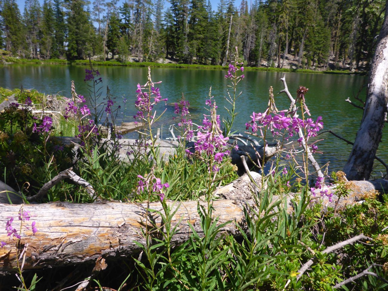
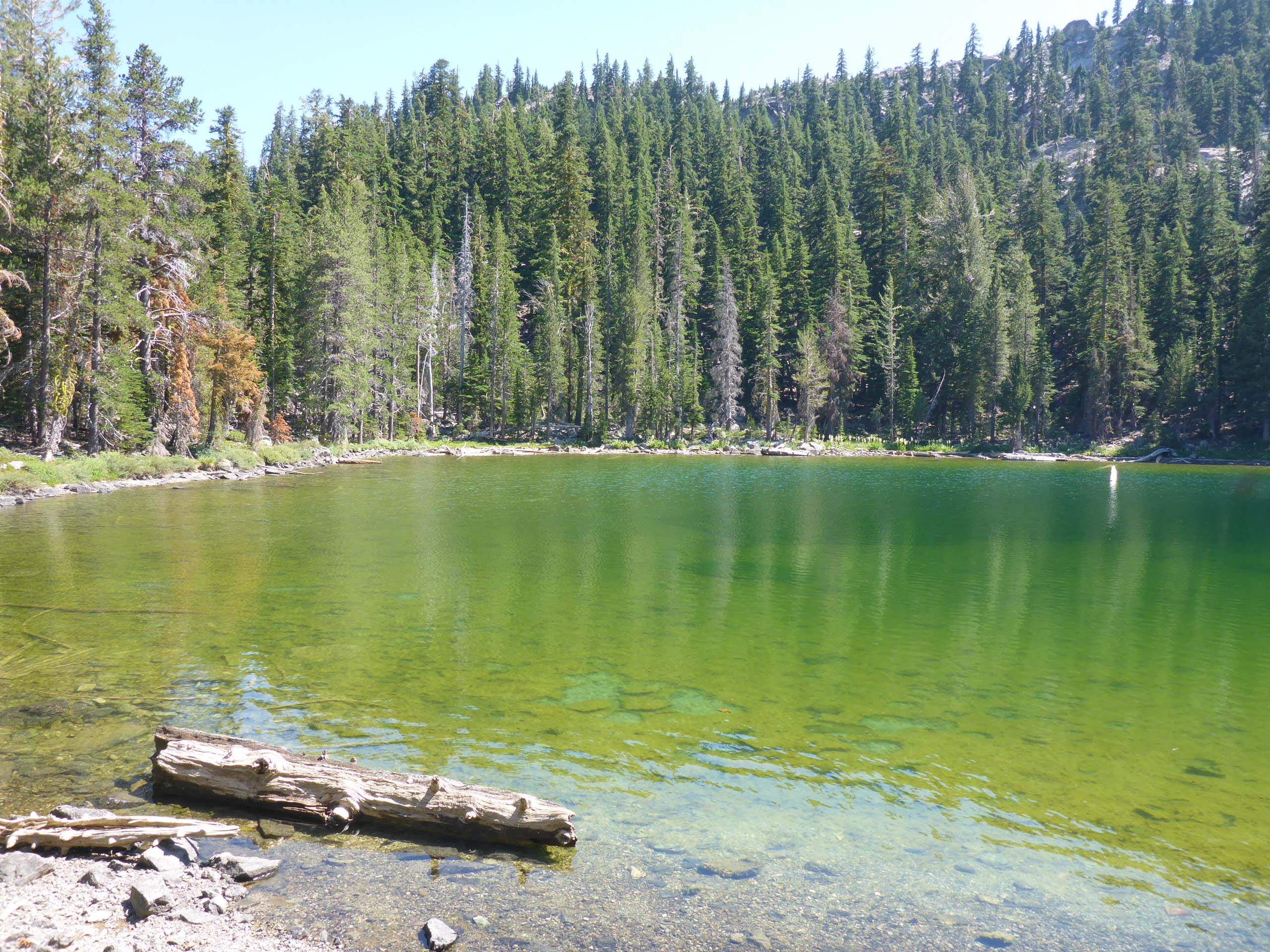
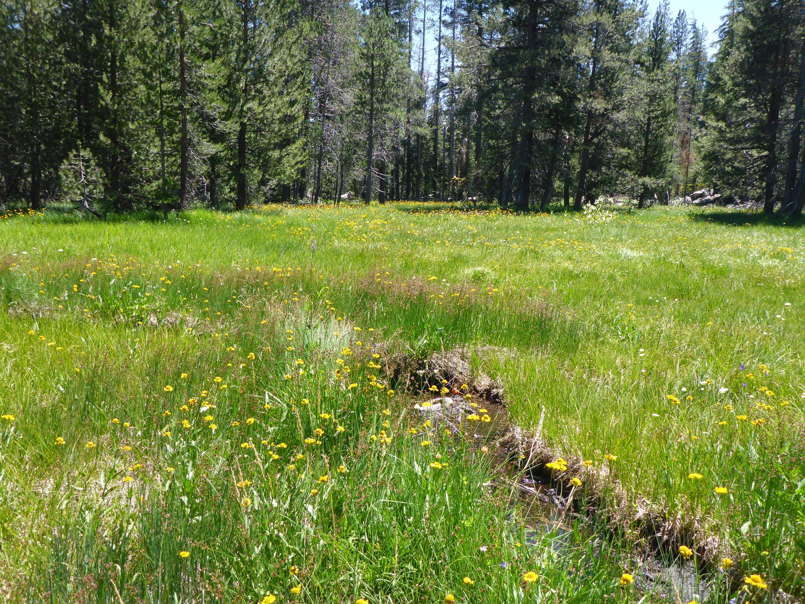
Perhaps is was the heat. Perhaps it was the relentless grade. Perhaps it was just us… but we found this short, ~2-mile hike in the Shasta-Trinity National Forest to be quite difficult. But the destination was definitely worth the effort. Lower West Park Lake is set in a large verdant meadow brim-full of wildflowers. A lovely lake in a beautiful setting.
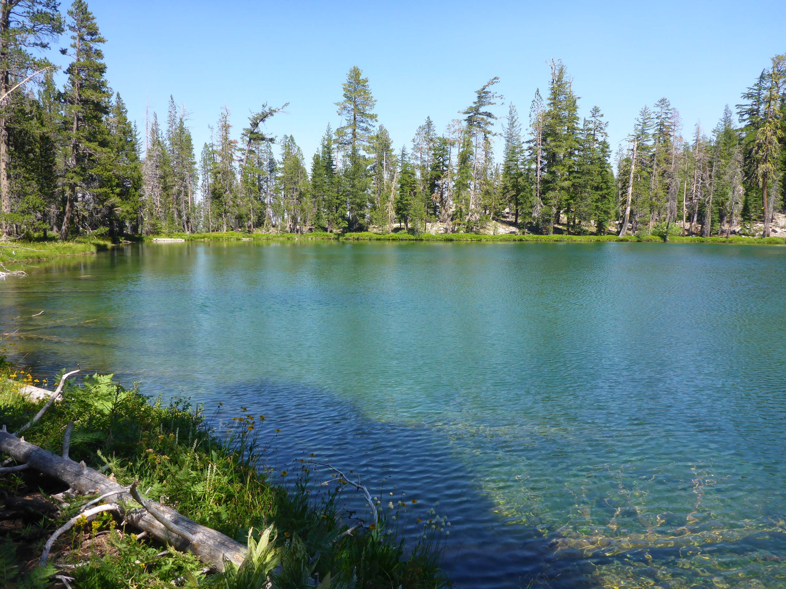
Of the three West Park Lakes, the upper one is said to be the prettiest, but we had neither time nor energy to climb to it. We did, however, make the quarter-mile cross-country trek up ~200 feet to Middle West Park Lake—a smaller lake somewhat less aesthetically appealing, but the hike to it did reveal several flowering species that we had not seen on the trail or at the lower lake.
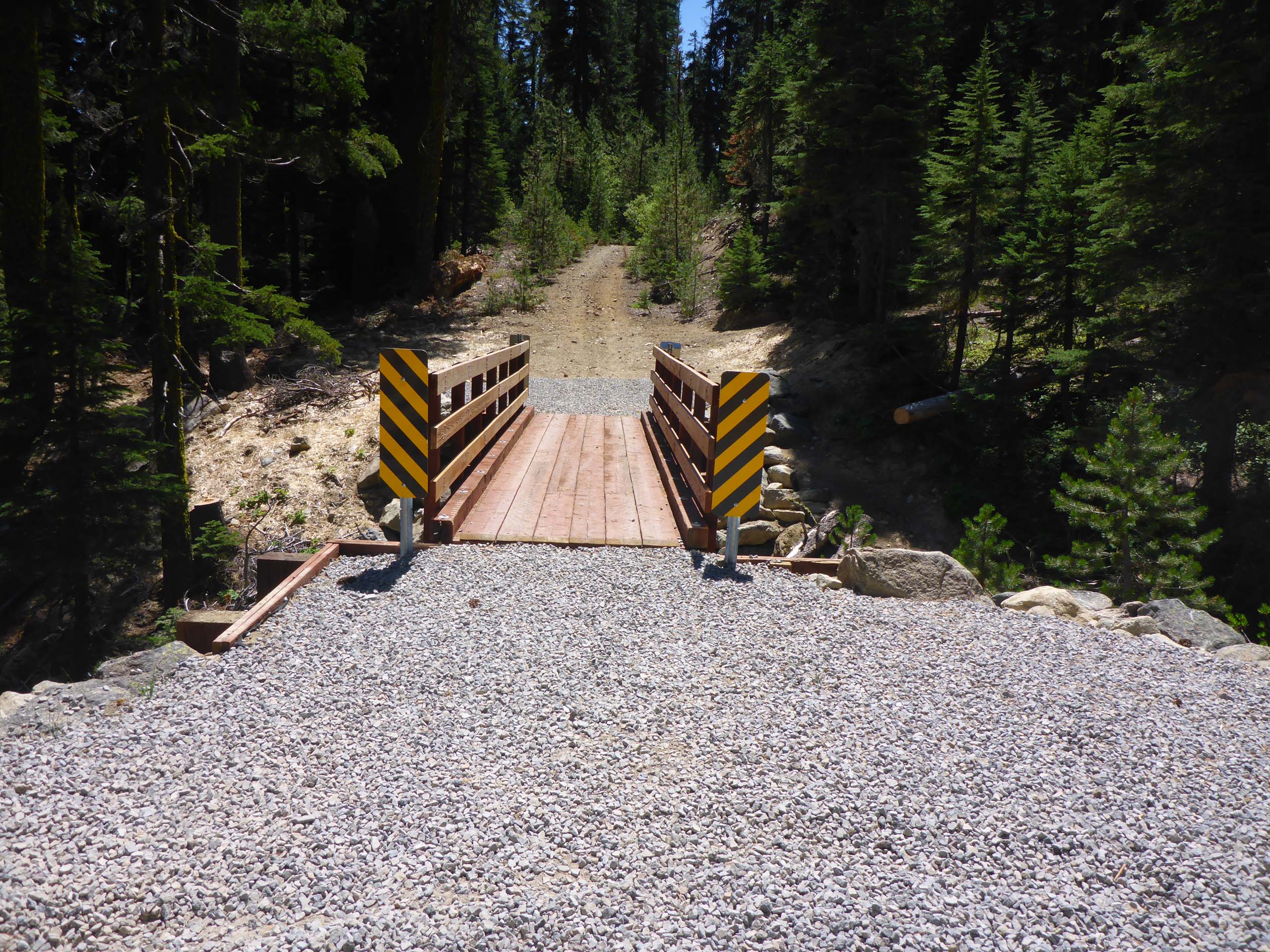
These lakes are in close proximity to Caldwell Lakes. To get to the trail that leads there, head out like you’re going to Caldwell Lakes, but turn off of Parks Creek Road earlier, at 4.4 miles, onto Forest Road 41N73. This is one rocky dirt road—you will want a high-clearance vehicle to navigate it. We were very glad to have 4-wheel drive, at least for the first mile or so. The road does get better once you cross the creekbed. The trail begins at the end of the road, at ~2.5 miles. There is no real trailhead, but a small parking area is obvious just before it narrows down to an ATV track after crossing a tributary to a fork of Parks Creek via a new, sturdy wooden bridge.
The first 1.5 miles of trail is really just an ATV track, with a gravelly, loose footbed that tends to roll and slip under one’s boot. Much of this track is densely lined with young conifers and shrubs, making a bit of a channel, with not much to see along the edges, and little shade.
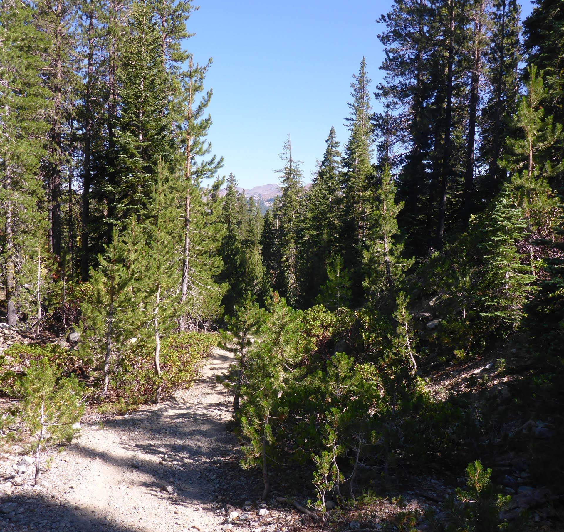
It does open up onto lush meadows in a couple of places, and in one spot, at about 0.75 mile, you’ll find yourself right next to a babbling creek, which is well worth a gander. At the end of the track, a “real” trail will take you the last 0.5 mile to the lake. This last section is steeper and more difficult, but comes as a relief as it runs through open forest.
The elevation gain to the lower lake is 1,100 feet, 1,300 feet to the middle lake. While we did find this hike to be challenging, we think that this was due more to our circumstances than to the trail and hike itself, and so we will rate the difficulty of the hike to the lower lake as moderate. The destination more than makes up for any difficulties encountered en route.
We hope you enjoy the following slideshow of blooms and other interesting sights that we found on our hike. All photos by Don Burk. ~Laurie & Don Burk


