
Massacre Flat, on the Yana Trail in the Sacramento River Bend Recreation Area, is just about equidistant from trailheads on Jelly’s Ferry Road to the west and Bend Ferry Road to the south. It makes for a fairly certain destination of solitude; we have very rarely encountered others at Massacre Flat.
To get to Massacre Flat, one can start at either Jelly’s Ferry Trailhead or Oak Slough Trailhead on Jelly’s Ferry Road, or at Perry’s Riffle Trailhead at the end of Bend Ferry Road. On this Sunday’s hike, we chose to access Massacre Flat from Jelly’s Ferry Trailhead, making for an ~9.5-mile hike of moderately easy difficulty. Because we have recently posted two articles on hikes to Inks Creek and vicinity (Oak Slough Trailhead, Fall 2020 and Oak Slough to Inks Creek, December 6, 2020), we will focus on the Yana Trail between Inks Creek and Massacre Flat.

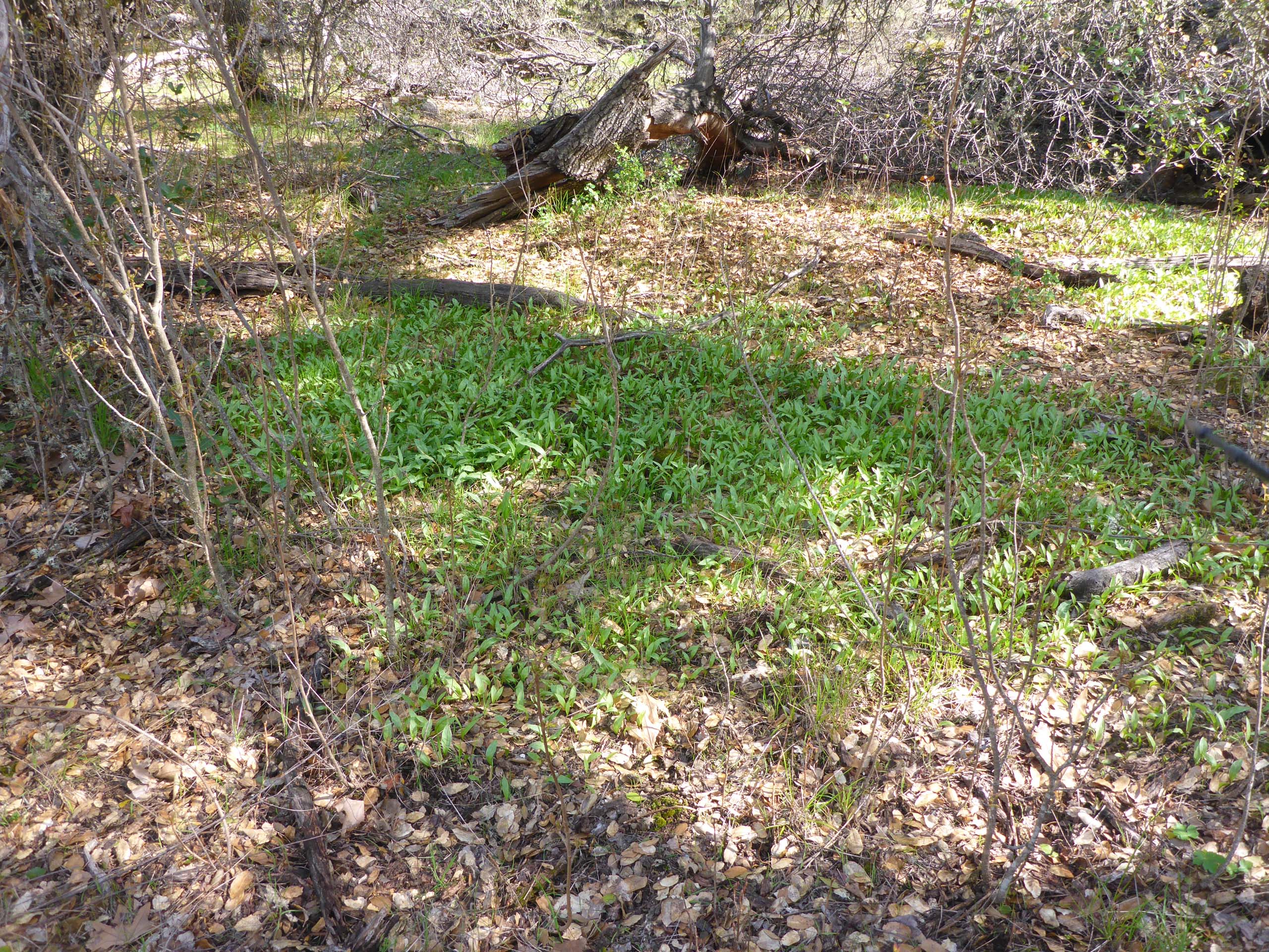
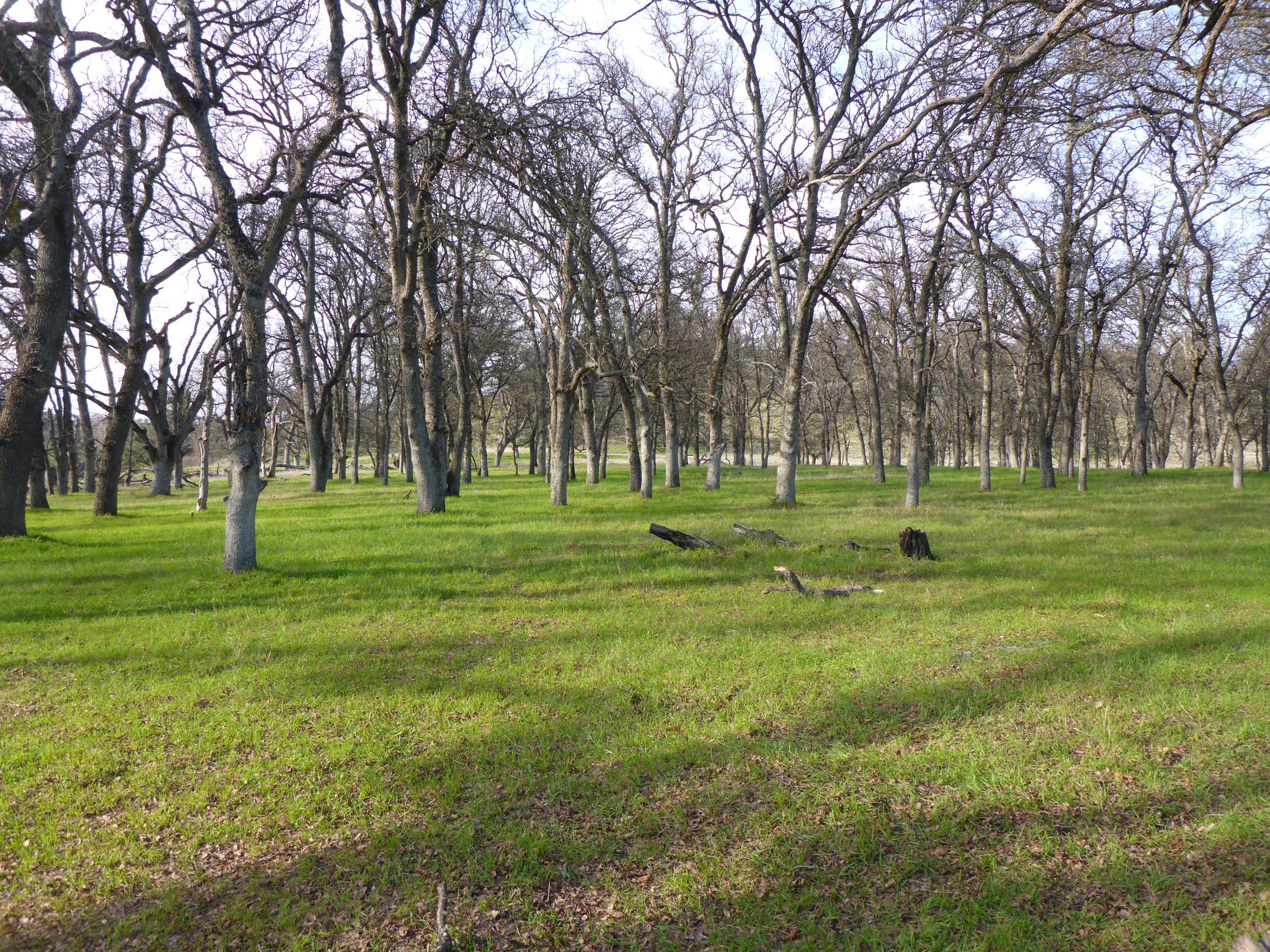
On the other side of Inks Creek, which was low when we were there and easily crossed, the trail meanders gently through grasslands and open blue oak woodland for ~0.5 miles to a wide, unnamed creek that is often dry or only spotted with standing pools. Checking out the progress of the fawn lilies that we know grow here was one of our main objectives in choosing this particular trail. And while the fawn lilies were not yet blooming, nor even budding, we were stunned by the sheer number of plants that were leafing out. They must number in the thousands, thickly carpeting patches along the north-facing bank and hillside above.
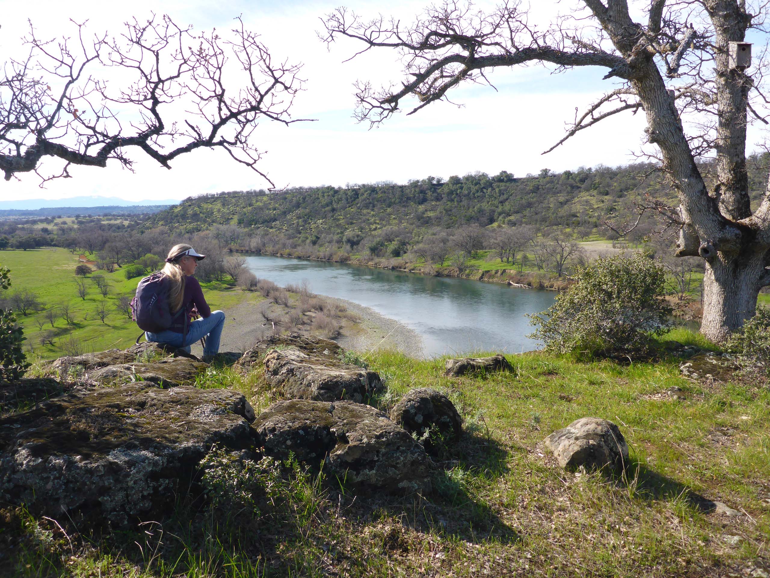
From this creek, the trail climbs gently (but rockily) up to the bluff over the Sacramento River. At the top, you’ll be awed by gorgeous views of the river below, but a must-see vista from a nearby promontory is worth the detour. As the trail tops out and makes a sweeping bend southward, look for a more lightly used, unmarked trail that goes toward the north. Take that for a short distance; you will not be disappointed.
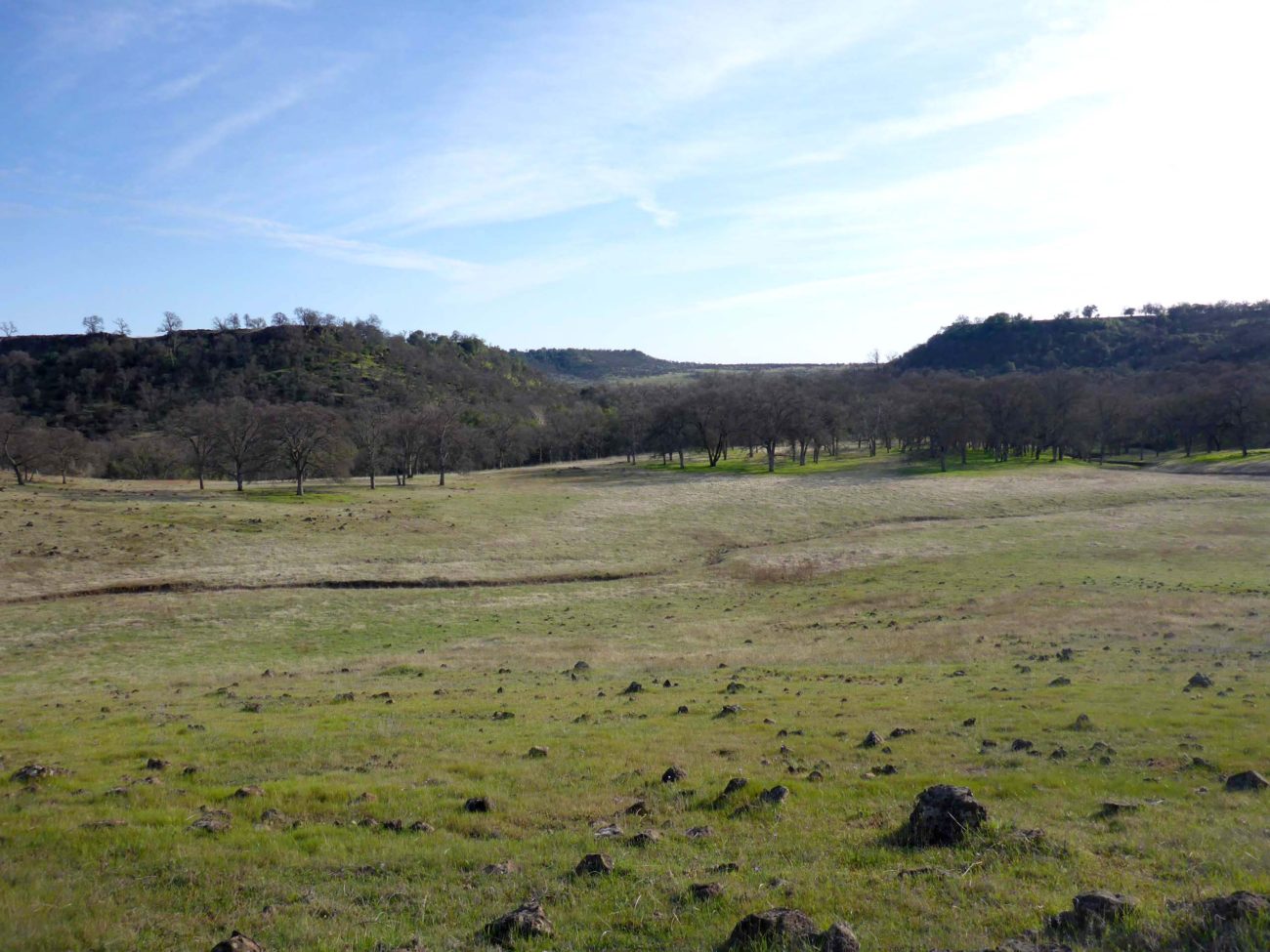
The trail continues south, generally following the bluff over the river, for about a mile. Here, on top of this open, rocky ledge, we found several species characteristic of thin-soiled, grassy flats: Cleveland’s shootingstars, goldfields, yellow carpets, fryingpan poppies… It is still very early in the season, but our blooming-species count for this hike approached 50—there is plenty to see!
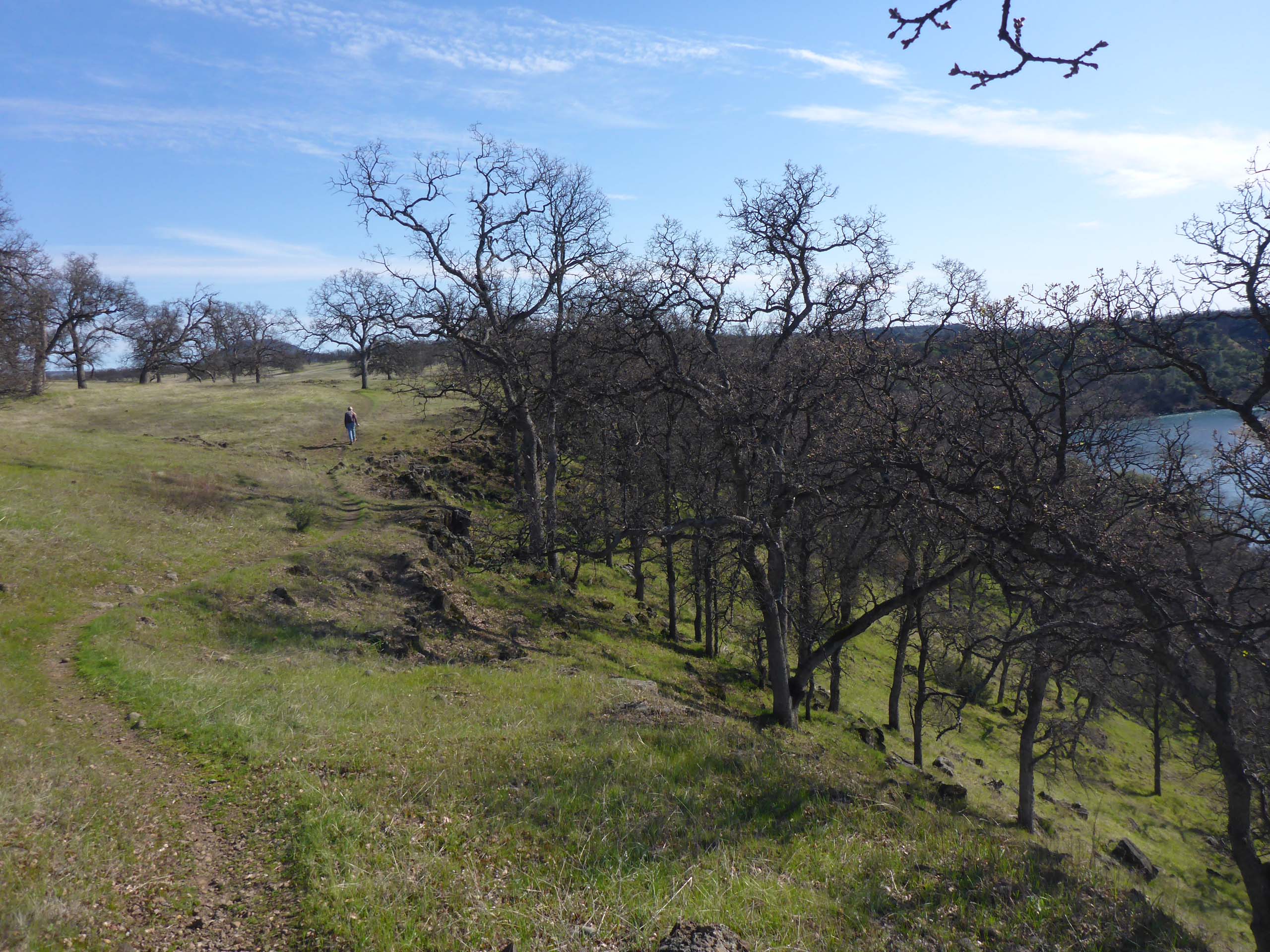
Soon the trail seems to turn inland from the river, and in fact it is meeting up with the trail that runs down to Massacre Flat. Three trails are marked on a metal pole at their juncture. The trail that leads down to the river will take you to an open, wooded area just above an extensive beach.
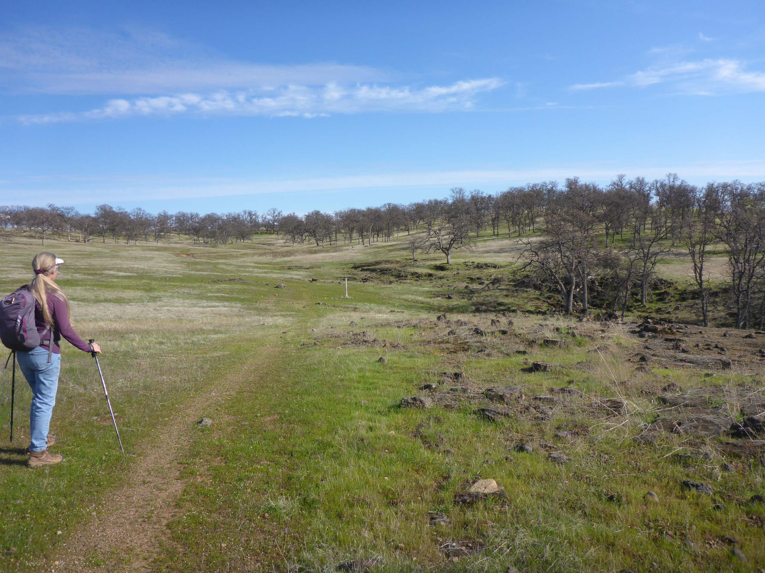
Here is Massacre Flat: an idyllic spot under a canopy of oaks, on a secluded bend of the river. It is easy to imagine a band of Native Peoples gathered here, going about their daily business. And although we can find no documentation related to this specific site, it is also easy to imagine how it might have gotten its name, nearly 150 years ago, when settlers throughout this area were systematically removing Native Americans from their lands.
We suspect that the majority of visitors come via river rather than trail, and that the site may see heavy use at times. There is a metal pole near the river marking the location, several campfire rings on the beach, and a pit toilet that was was open this visit (we often find it locked). But this Sunday, like so many other times that we have been there, we had the place to ourselves. Perfect spot for a bite to eat before heading back.
Here is a slideshow of some of our better photos of pre-spring flora that we saw that day, all taken by Don Burk. Enjoy! ~Laurie & Don Burk


