
On numerous occasions, I’ve enjoyed the two-mile section of the McCloud River Trail, which begins at the Lower Falls parking area near Fowlers Campground and connects the Lower, Middle, and Upper Falls. All three falls make for spectacular viewing. It never occurred to me that the trail might continue beyond the Upper Falls. In fact, the trail continues another 13.2 miles!
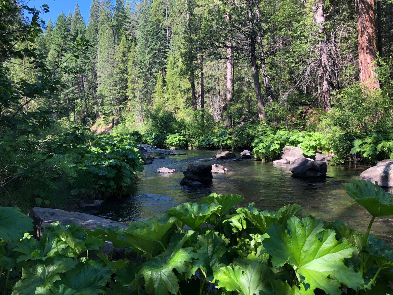
We (wife Billie, my sister Kit, Baxster, and I) parked at the Upper Falls parking lot and headed upstream for approximately three miles before retracing our steps. Most of this section of the trail is well shaded by ponderosa pines, Douglas-firs, white firs, and black oaks. Mostly level, there is only one short stretch where lava rocks make for uneven footing.
Blossoms we encountered included leopard lily, Bigelow’s sneezeweed, Indian rhubarb, prettyface, scarlet gilia, dwarf checkerbloom, Hartweg’s wild ginger, pine violet, thimbleberry, Indian paintbrush, yellow salsify, oxeye daisy, and pipsissewa (see slideshow at end of article).
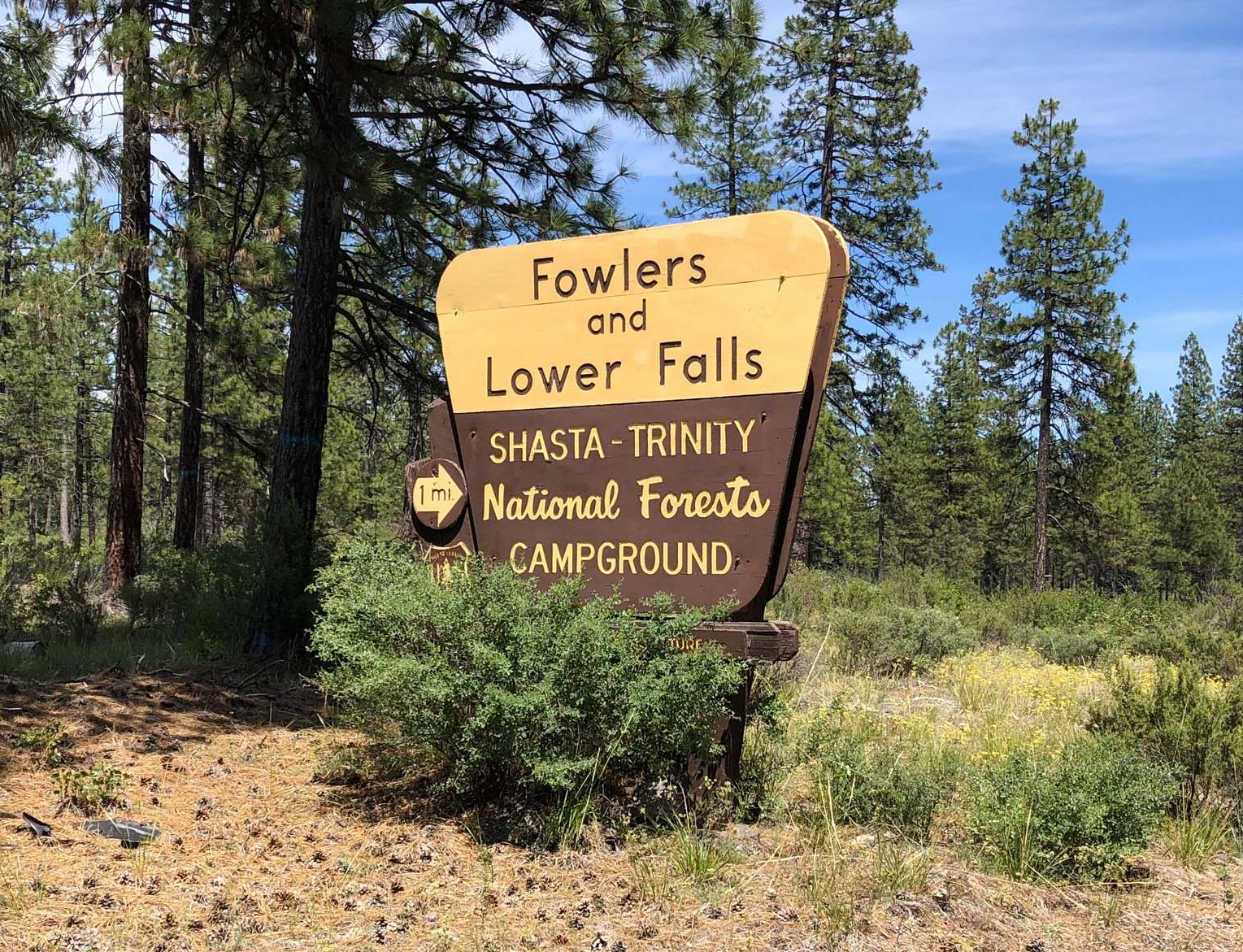
The McCloud River Trail is about a 90-minute drive from Redding. From McCloud, drive 5 miles southeast on Hwy 89. Look for a sign on the left-hand side of the highway that reads “Fowlers and Lower Falls.” Turn right (south) onto Fowlers Public Camp Road at this sign.
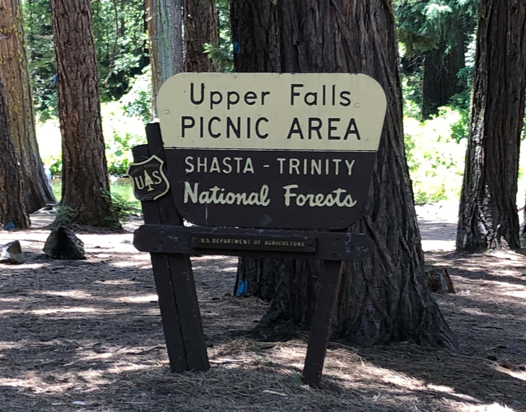
Look for the sign that directs you to the Upper Falls. Park in the picnic area parking lot and head upriver. Be sure to bring along mosquito repellent and water to drink. -Chris Harvey
Please enjoy the following slideshow of blooming plants on the McCloud River Trail. All photos by Chris Harvey, taken June 20, 2020.


