
We were surprised that we were too late to see many of the species that we expected to see blooming on this section of the Pacific Crest Trail (PCT). Many flowers were fading fast, and already several species were setting fruit. The number one takeaway from this hike was that the drought has curtailed any hope of a prolonged spring. In fact, the amount of stress apparent in shrubs so early in the season is an ominous sign that we are in for one very hard summer.
It’s still a very nice hike, if only for the views, but if you want to see lots of bloomers on Hat Creek Rim, try the south end. We have it on very good authority that you can still see lots in bloom on the rim: a couple of PCT-section backpackers that we met on the trail assured us that there we lots of “yellow flowers, and white flowers, and purple flowers” only 10 to 15 miles south. See our write-up, Hat Creek Rim PCT, June 14, 2020, for suggested hikes on that section of trail.
Easiest access to the north end of Hat Creek Rim PCT is from Forest Rte 7R02, off of Cassel Fall River Road. From Burney, continue a couple miles NE on Highway 299 and turn right onto Cassel Road. At 8.2 miles, shortly after driving through the very tiny community of Cassel, Cassel Road splits into two roads: Cassel Road veers south, and Cassel Fall River Road continues east. Stay left and take Cassel Fall River Road for another 4.2 miles to a dirt road on the right. This is Forest Rte 7R02—it is not signed, and a high-clearance vehicle is recommended. We like to park in the open area at the power pole, ~0.75 miles in, where it is fire safe and has plenty of room to turn around. From there we continue down the road on foot for another ~0.25 miles to the point at which the PCT crosses.
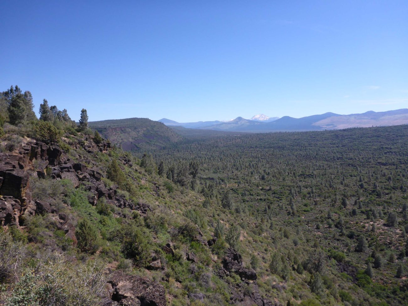
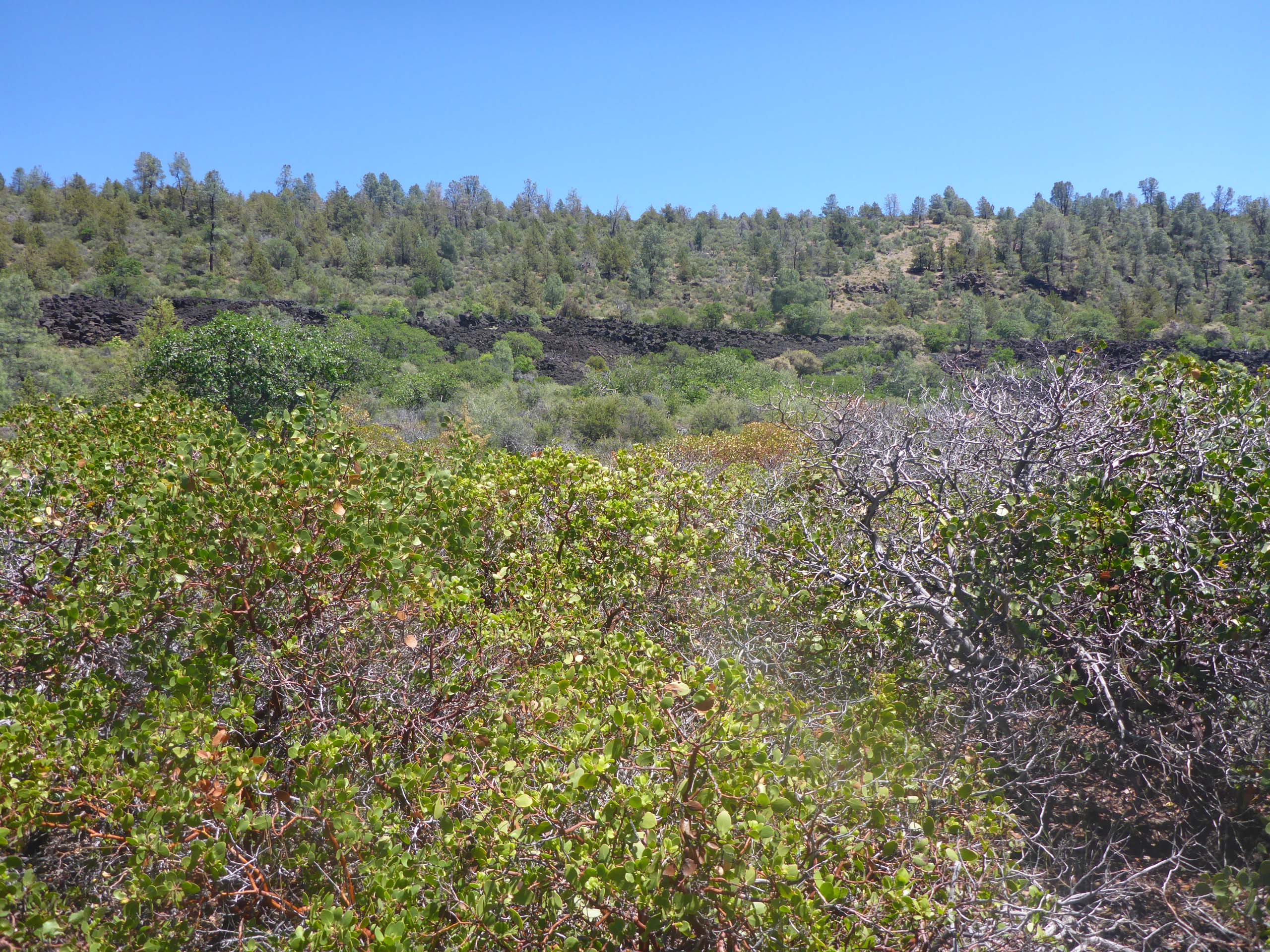
From here, the PCT winds through manzanita and ceanothus, past the occasional conifer, and over a cool lava bench. Within a mile, the trail gently switchbacks up to the rim. There are far more trees at this end of the rim—ponderosa and gray pines, junipers, black oaks—but the views are just as stunning as in the more open south trail. We poked along for another couple of miles before heading back, making for ~6-mile hike. Due to the rocky footbed in the lower section, especially in the lava, and a couple of steep-ish parts, we’d rate the difficulty of this section of the trail as moderate.
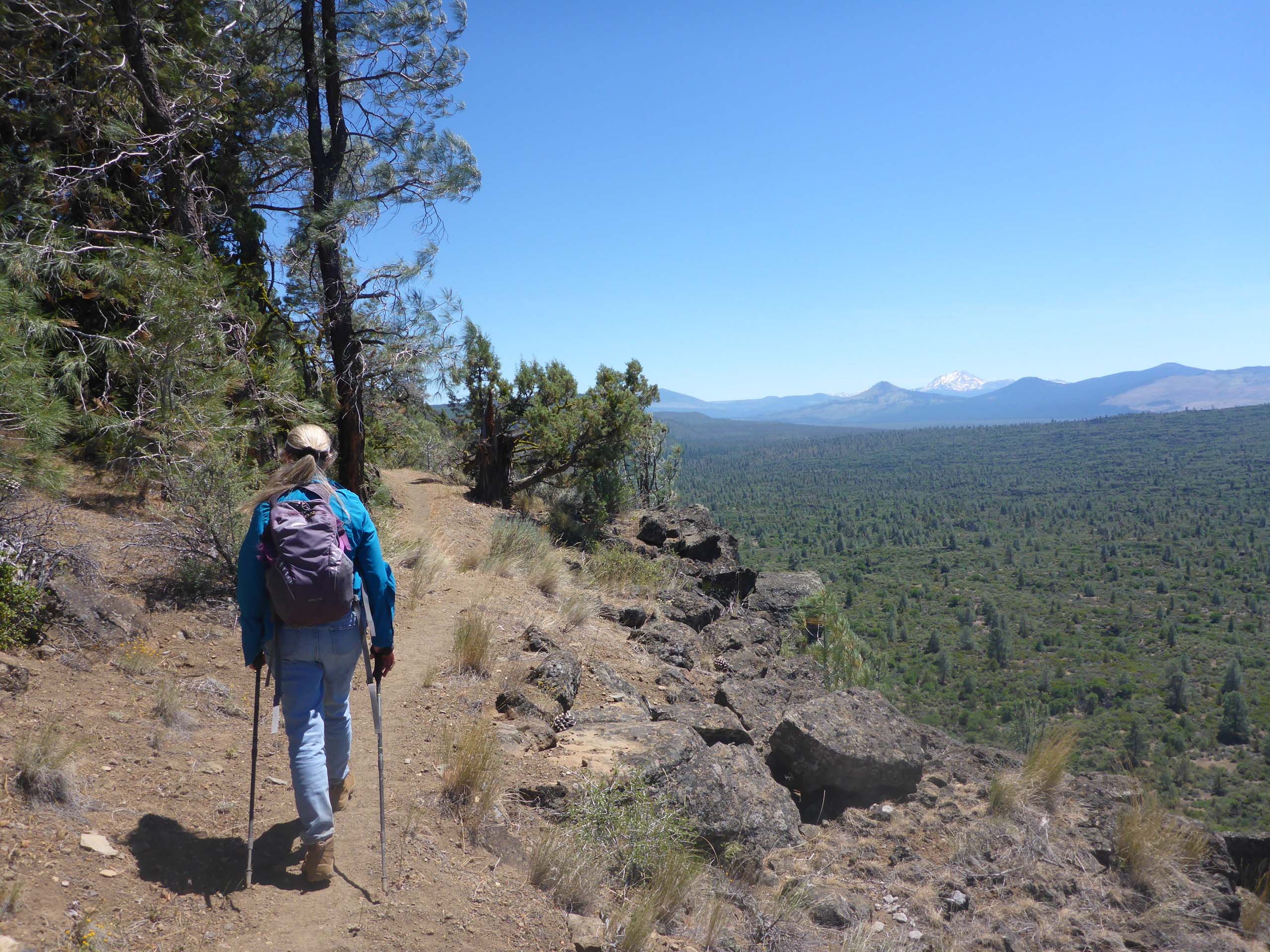
Photo by Don Burk.
While the blooms were a little disappointing (and the winds were gale-force on the rim!), Don was able to get a few photos of some of the things we stopped to admire. We have shared them here, in the following slideshow. Enjoy! ~Laurie & Don Burk


