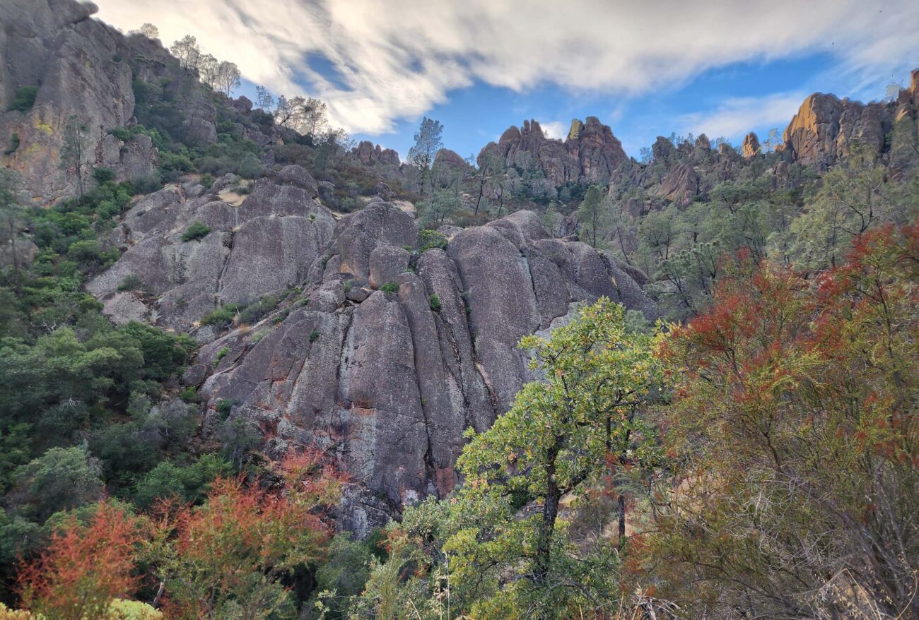
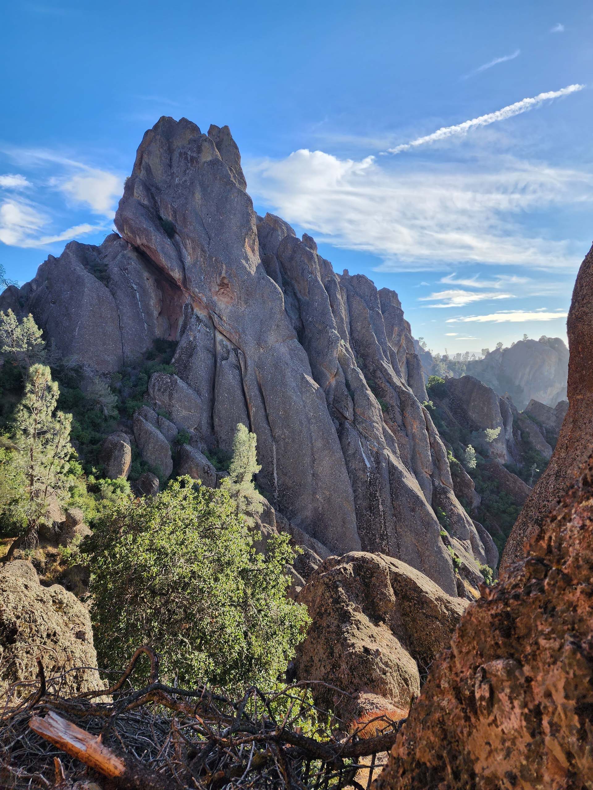
View of the pinnacles at Pinnacles National Park. This and all photos in the following article were taken in the Park by Don Burk on December 7, 2023.
We had to be in Monterey in early December; since the weather was gorgeous, we opted to spend an extra day in the area to hike some new terrain. Our spur-of-the-moment decision to explore Pinnacles National Park proved to be an exceptional choice!
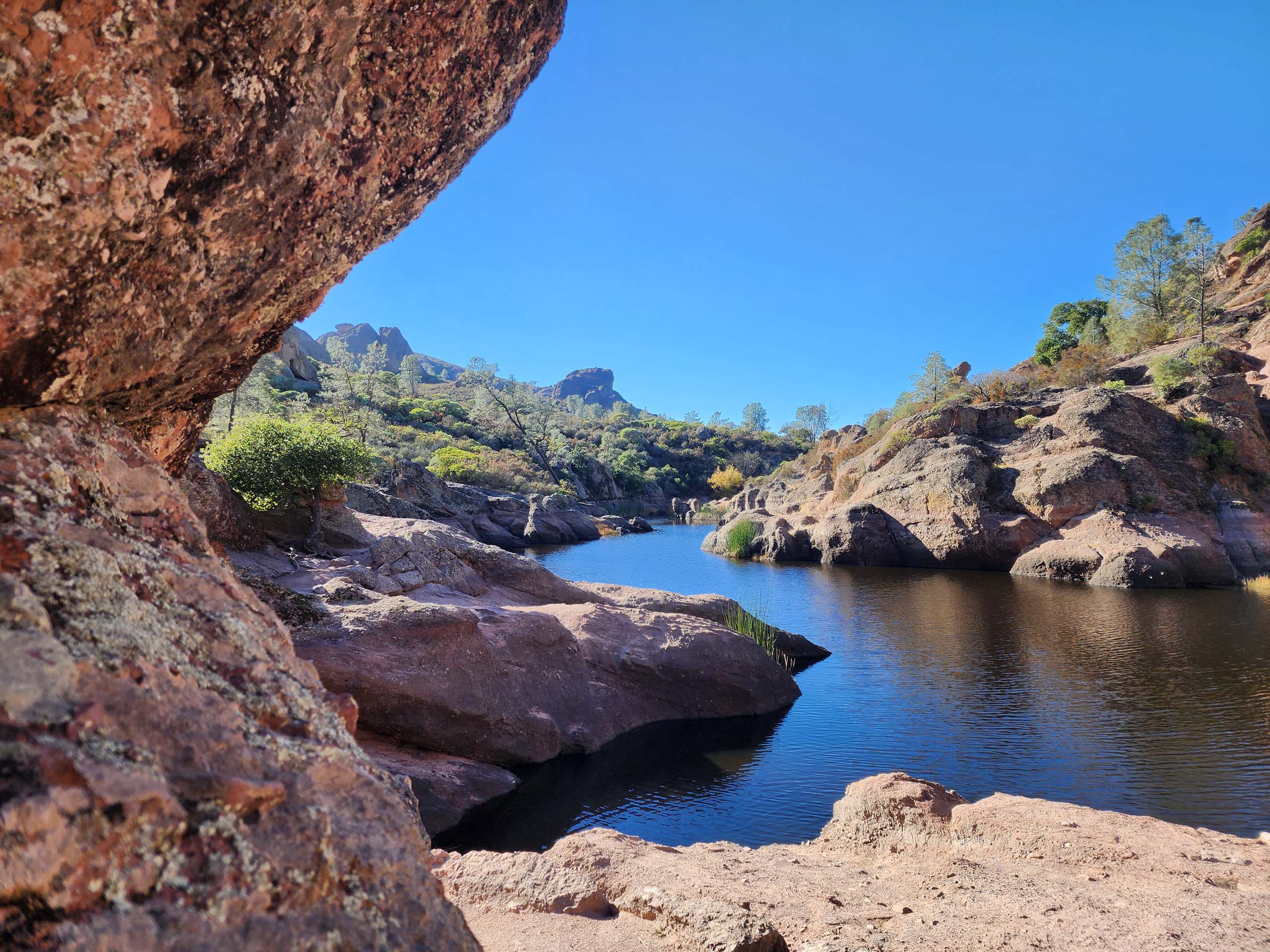
We accessed the Park from its east side, thoroughly enjoying the landscape while driving along Highway 25 south of Hollister. After a quick stop at the Visitor’s Center for a map and some trail information, we headed out to the Moses Spring Trailhead and up to Bear Gulch Reservoir.
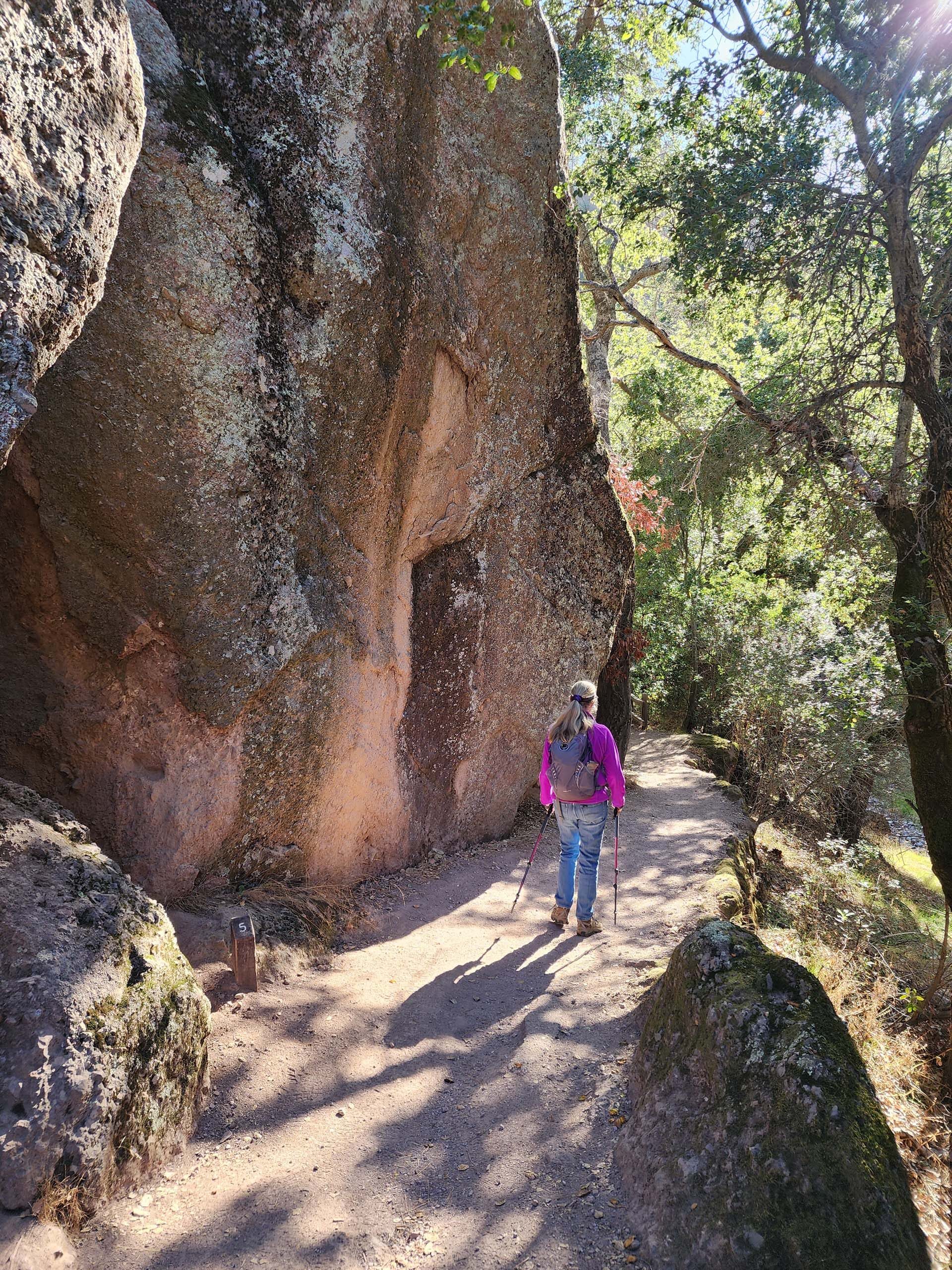
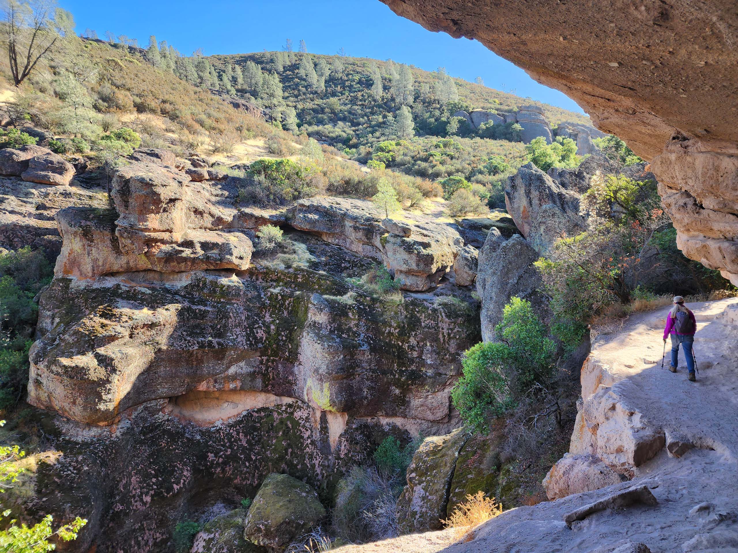
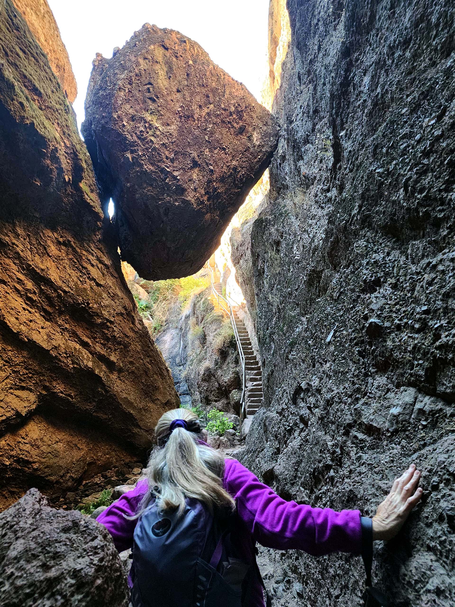
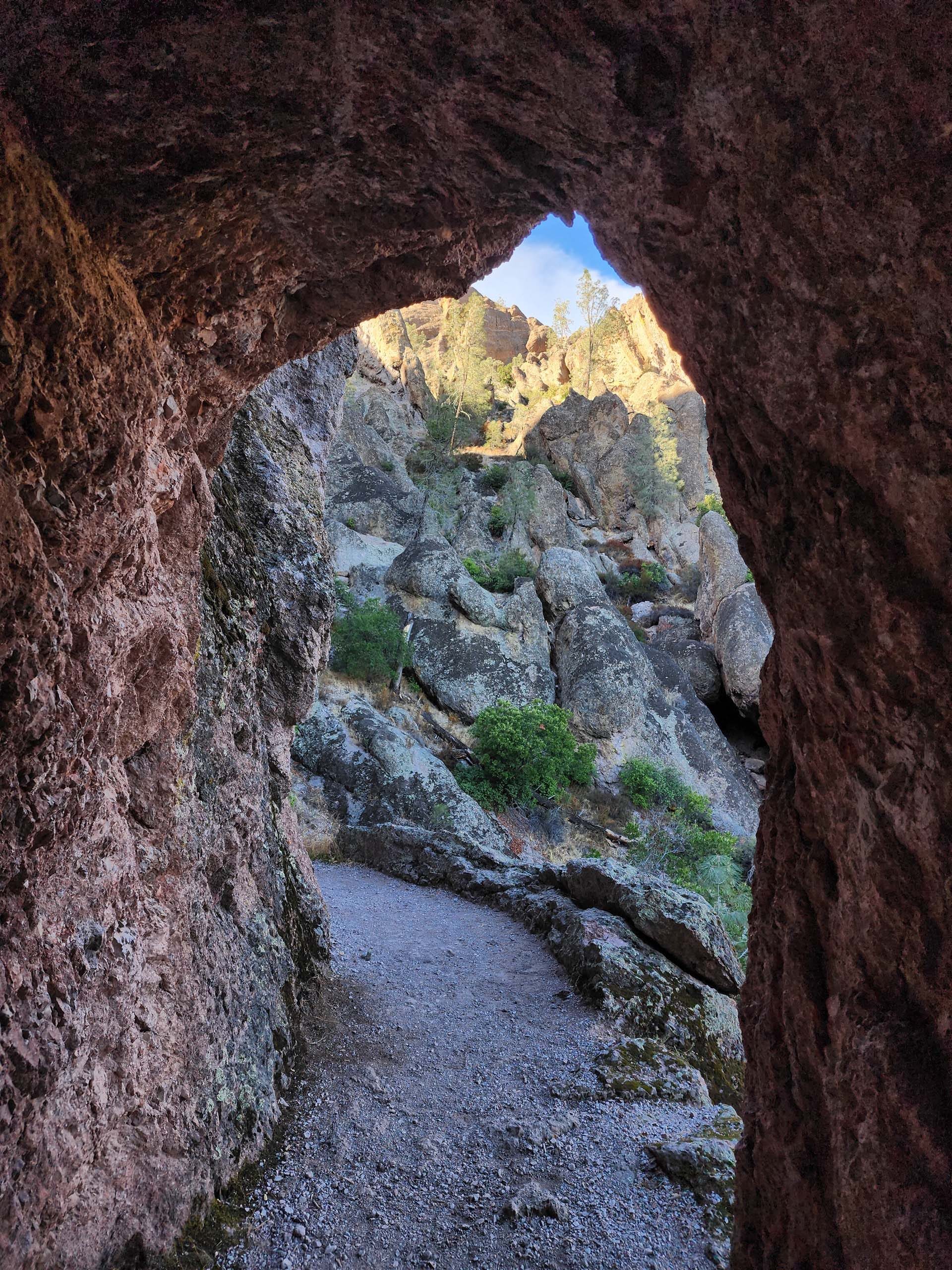
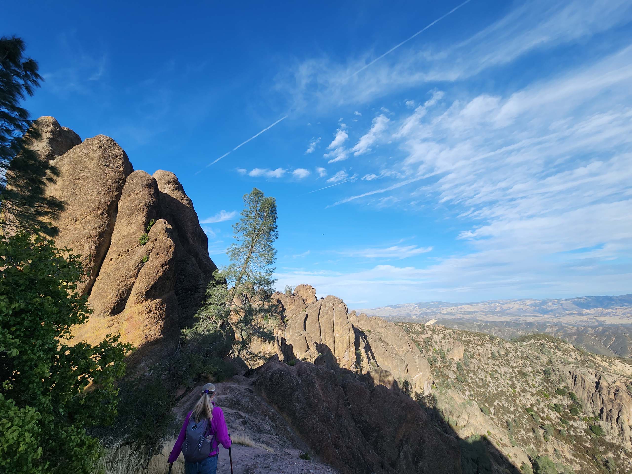
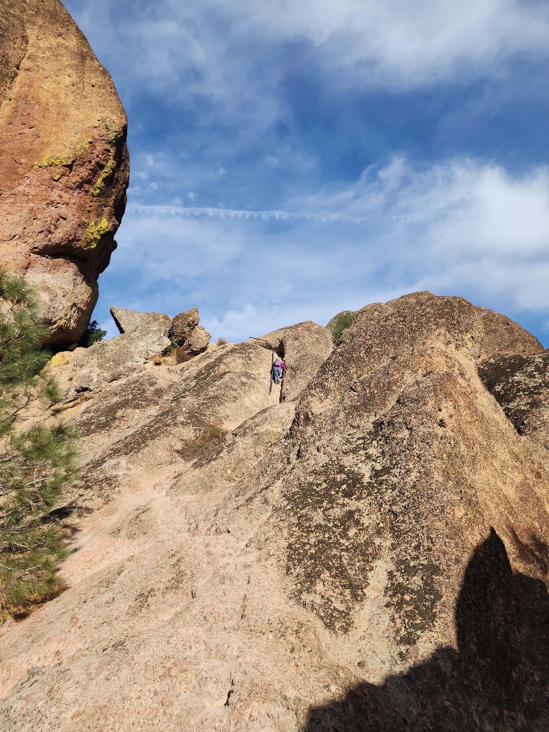
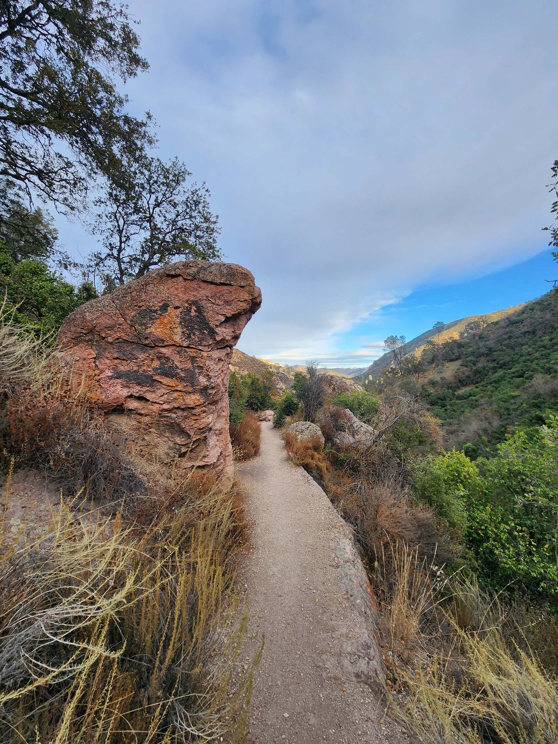
The Moses Spring Trail wends along riparian habitat and ascends into rock formations offering cave exploration opportunities.The well-worn footbed of Moses Spring Trail suggests heavy use during the peak season—but we met only a handful of other hikers during our off-season visit.Access through this rugged terrain was made possible by the California Conservation Corps (CCC), who constructed stairways and footholds (with and without railings) in the 1930s and early ‘40s.The striking, sinuous Bear Gulch Reservoir is formed by a CCC-era rockwork dam. Although we initially considered making a short loop back to the trailhead at this point, the trail drew us onward and upward. We took the Rim Trail and then climbed up the High Peaks Trail to the heart of the Pinnacles.The upper trails access both pinnacles and panoramas—incredible views, both close up and in the distance.Most of the Park is below 3,000 feet in elevation, and features chaparral, grassland, and oak woodland habitats. However, the understory plants are intriguingly different than those found in similar habitats in Shasta Chapter territory.High Peaks Trail is posted as “Steep and Narrow,” so of course we had to go… Laurie can be seen as a pink speck nearing the top of this rocky ascent.As we twined through the crags and descended Condor Gulch Trail, we observed at least a half-dozen condors, some wheeling overhead or at eye level, and others perched on the spires.Back in the lowlands, Condor Gulch Trail enters Bear Gulch, where we returned to the Moses Spring Trailhead parking area, making for an incredible loop hike a little over 6 miles in length. And there’s another 25 miles of trail to explore! We’ll be back!
The Pinnacles was established as a National Monument by Teddy Roosevelt in 1903, and became a National Park in 2013. The west side of the park can be accessed via Highway 146 near Soledad (about 30 miles southeast of Salinas), while the east side is entered from Highway 25, about 30 miles south of Hollister. There is no through-connection for vehicles; it is nearly a 70-mile drive from one side of the park to the other via King City. Given its low elevation, temperatures can exceed 100 °F during the summer. So, plan on a spring visit for wildflowers, a fall visit for wonderful hiking weather, and a winter visit for solitude! ~Don & Laurie Burk