
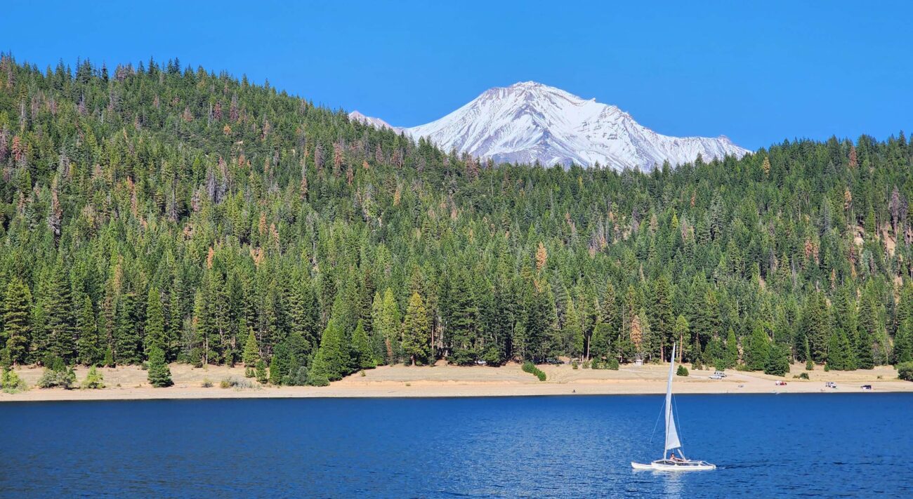
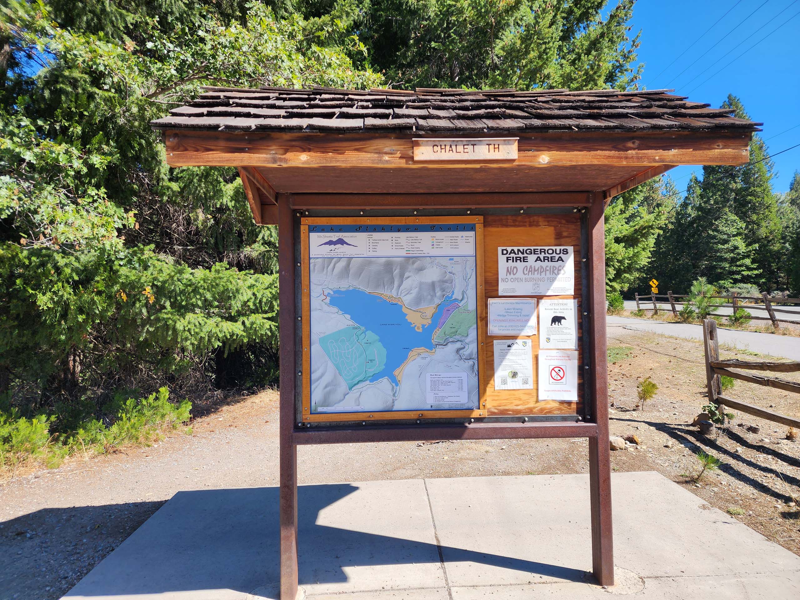
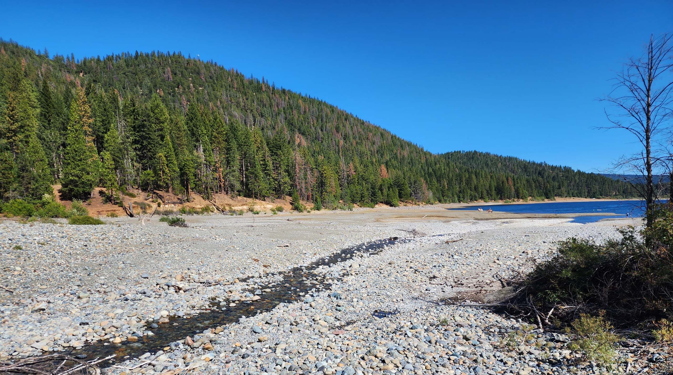
After years of driving past Lake Siskiyou on our way to higher elevations outside of Mt. Shasta, we finally decided to make the loop trail around this lake our destination. There are several trailheads from which to access this trail. We chose the first we came to on W.A. Barr Road—Chalet Trailhead. There are a couple more access points on this road, plus several that take off from North Shore Road, on the north edge of the lake.
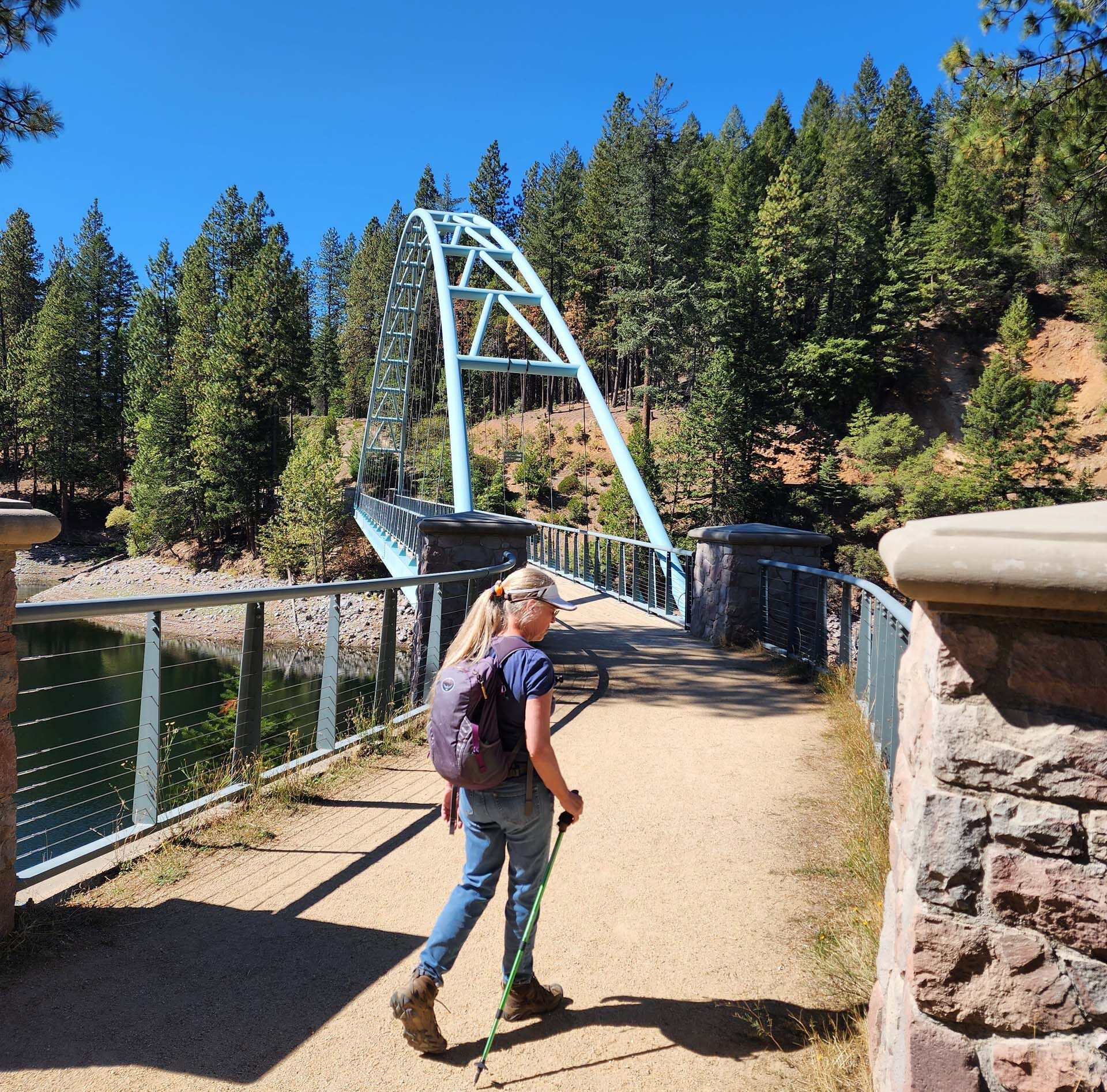
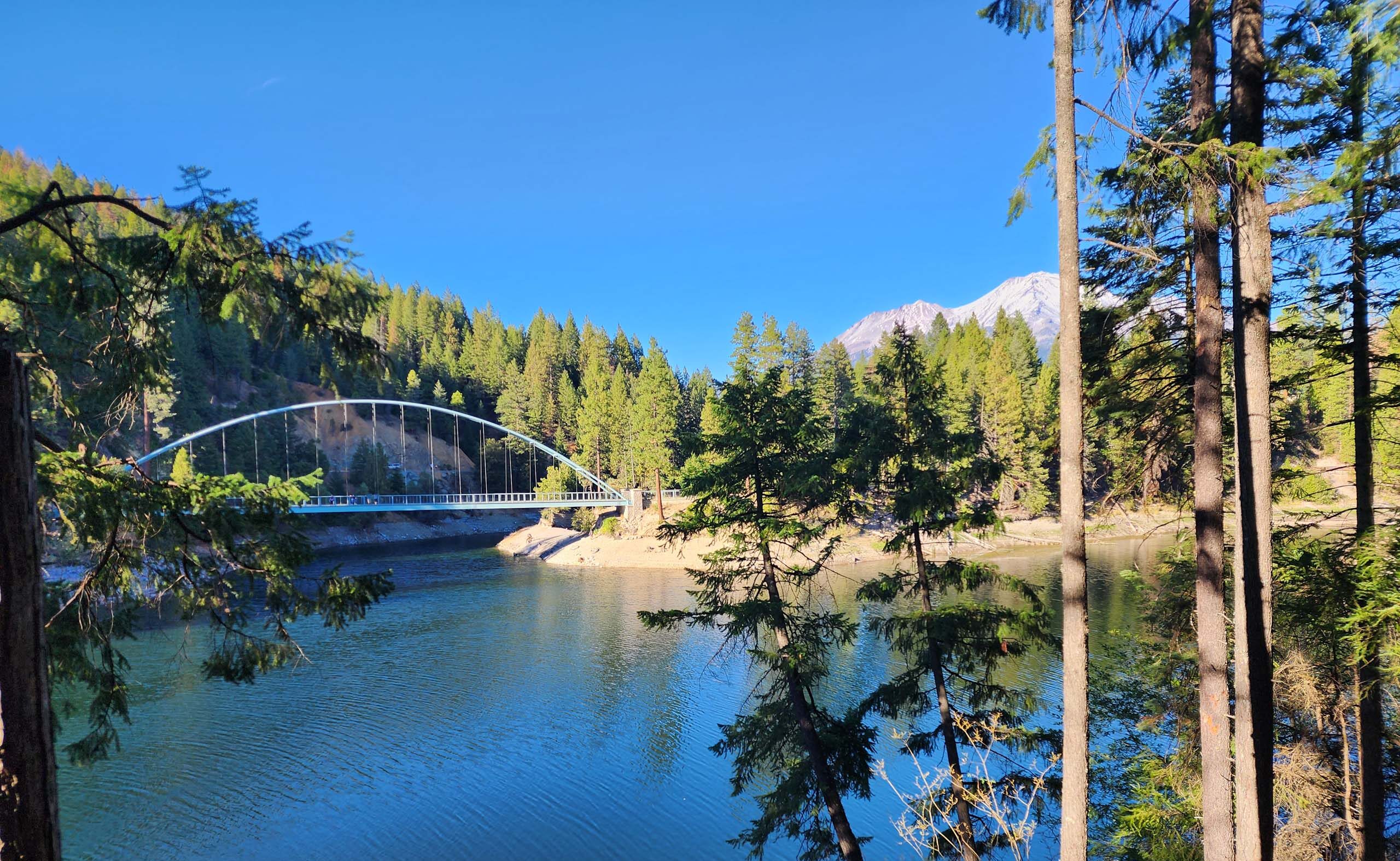
This trail is very nicely maintained and relatively flat for its entire 6.5 miles. Most of the trail runs through open forest at a distance from the lake shore, but one is never so far away as to lose sight of the water. Wagon Creek Pedestrian Bridge is quite impressive at the northeast corner of the lake, and there are seasonal bridges at the northwest corner.
It is obviously a very popular recreation area; on this very warm and bright blue day, we saw other hikers, runners, bikers, horseback riders, dog walkers, picnickers, sunbathers, swimmers, paddle boarders, kayakers, and a guy sailing a catamaran. But for all that, it never felt crowded, and it was a very fun walk.
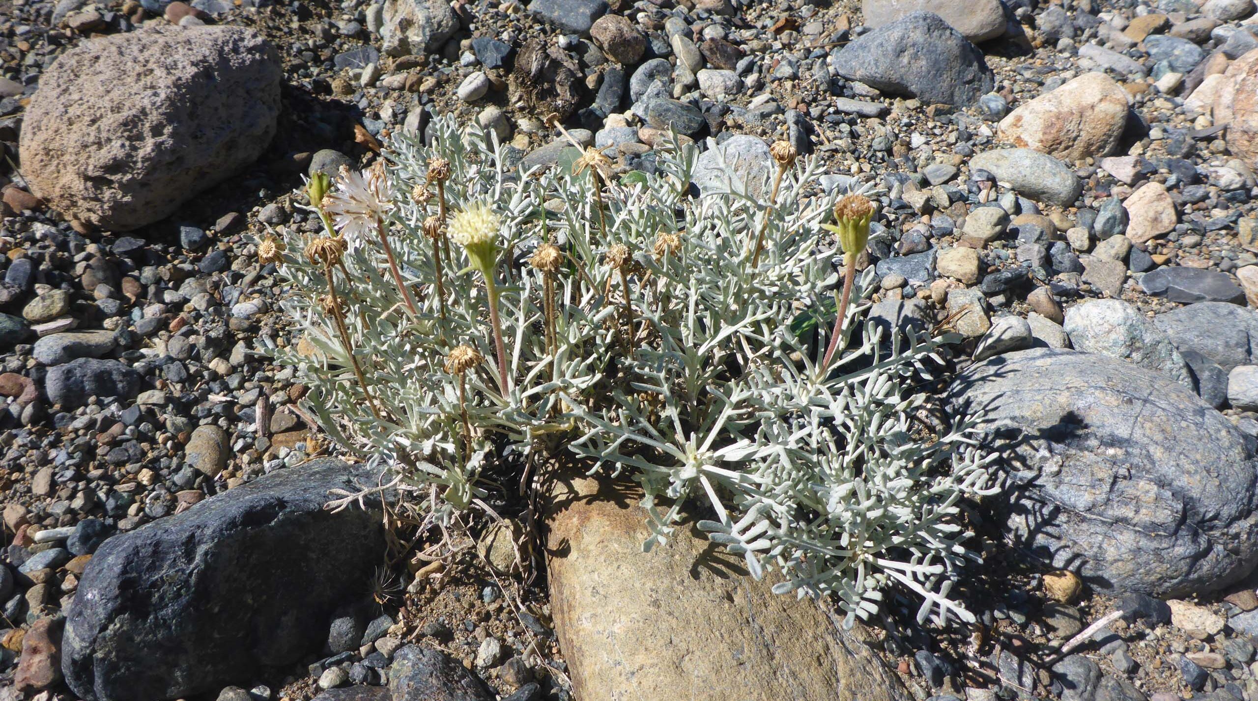
While not especially botanically interesting at the tail end of summer, we expect that spring might look a whole lot different. There was, however, one very interesting botanical find: the CNPS List 1B.3 rare species, Shasta chaenactis, (Chaenactis suffrutescens), was growing profusely in the gravel at the northwest tip of the lake.
Our overall impression was that this is a very nice recreational resource for locals, and we were glad to have made the effort to check it out. We’re betting that this trail could provide a really lovely fall-colors walk, starting right about now! One word of caution before you go: be sure to have a map handy. The trail through Lake Siskiyou Resort and Campground, along the south shore, is very poorly marked and very easy to lose. While you won’t get lost, a map will save you lots of time and frustration if you should find yourself accidentally off trail.
Here are just a few photos from our hike, all taken by Don Burk. ~Laurie & Don Burk


