Time constraints and a tweaked back found us casting about for a nearby, easy hike for our first Sunday hike of February, when we remembered that Juliet Malik led a field trip to some cool Redding trails that we were unfamiliar with and wanted to check out (see Sloppy Joe: Spring Edition! April 13, 2025). Perfect!
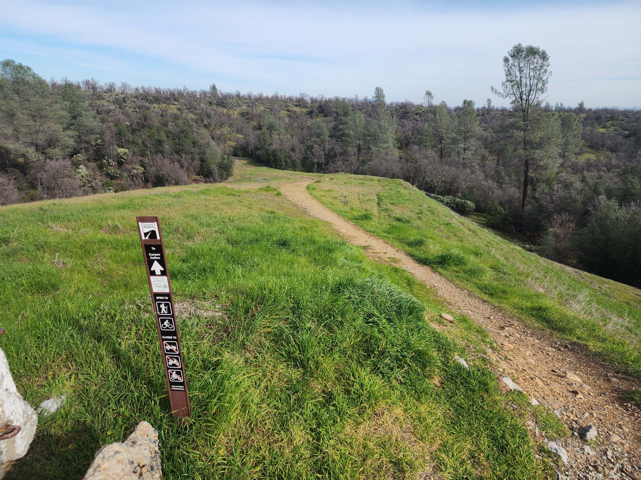
There are at least 12 miles of multi-use trails in West Redding’s Canyon Hollow Trail System, which generally connect the subdivisions of Country Heights to the south and Ridgeview to the north, via multiple access points. These trails are newish, growing, and very nicely maintained through a partnership between City of Redding Parks & Recreation and Redding Trail Alliance. They could use better signage at trail intersections—we relied heavily on GPS and a topo map—but the trails themselves are lovely.
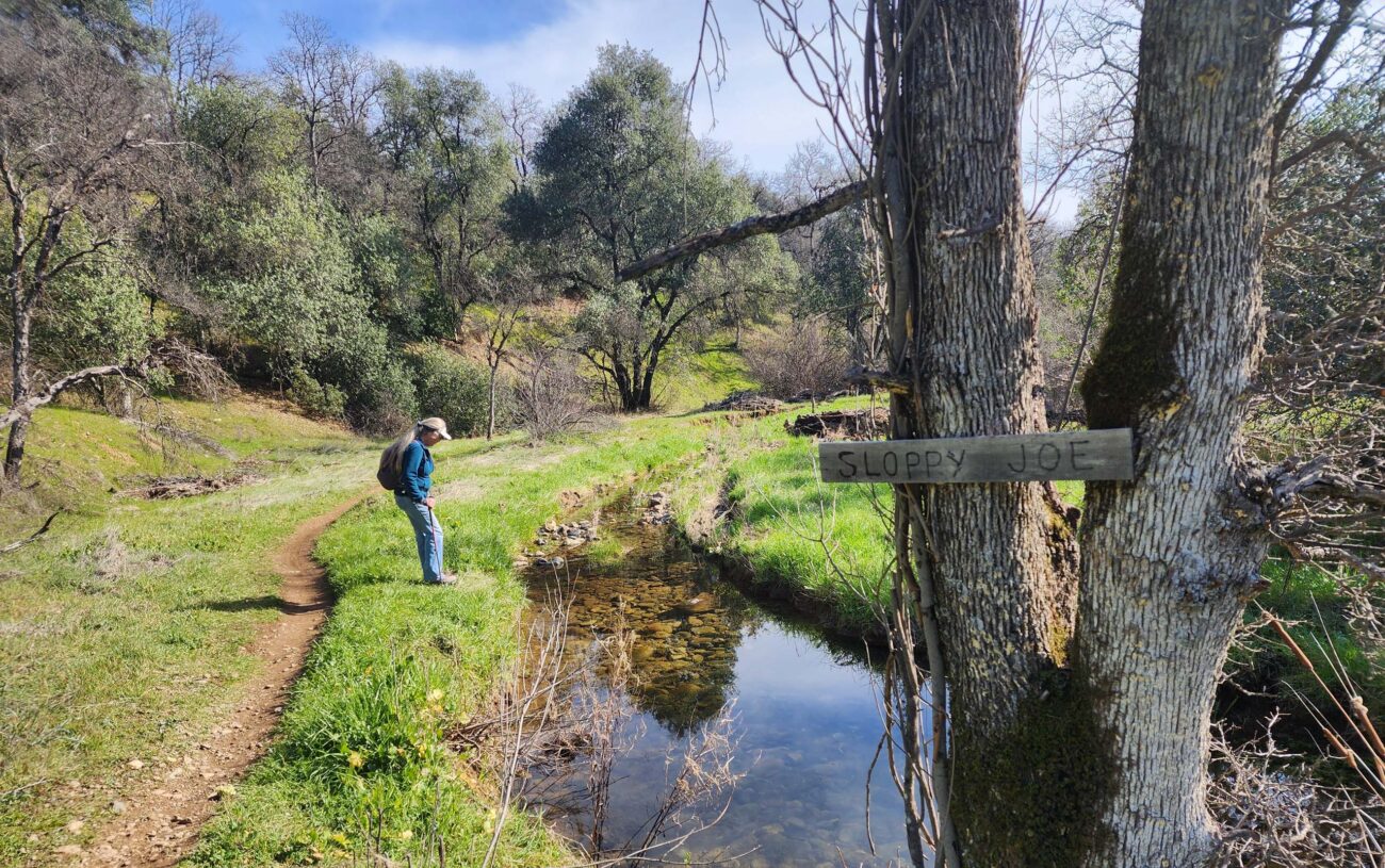
We had a little trouble deciding where best to start as we couldn’t find any designated trailheads, and it is clear that not all subdivision residents are thrilled to have access points near their homes. We chose to start at the end of Spicewood Drive, in the Country Heights subdivision, because it seemed the least intrusive. The beginning of a connector trail is marked with a simple trail marker at the end of the cul-de-sac. Developed trailheads, perhaps including maps, would be a huge improvement to this trail system.
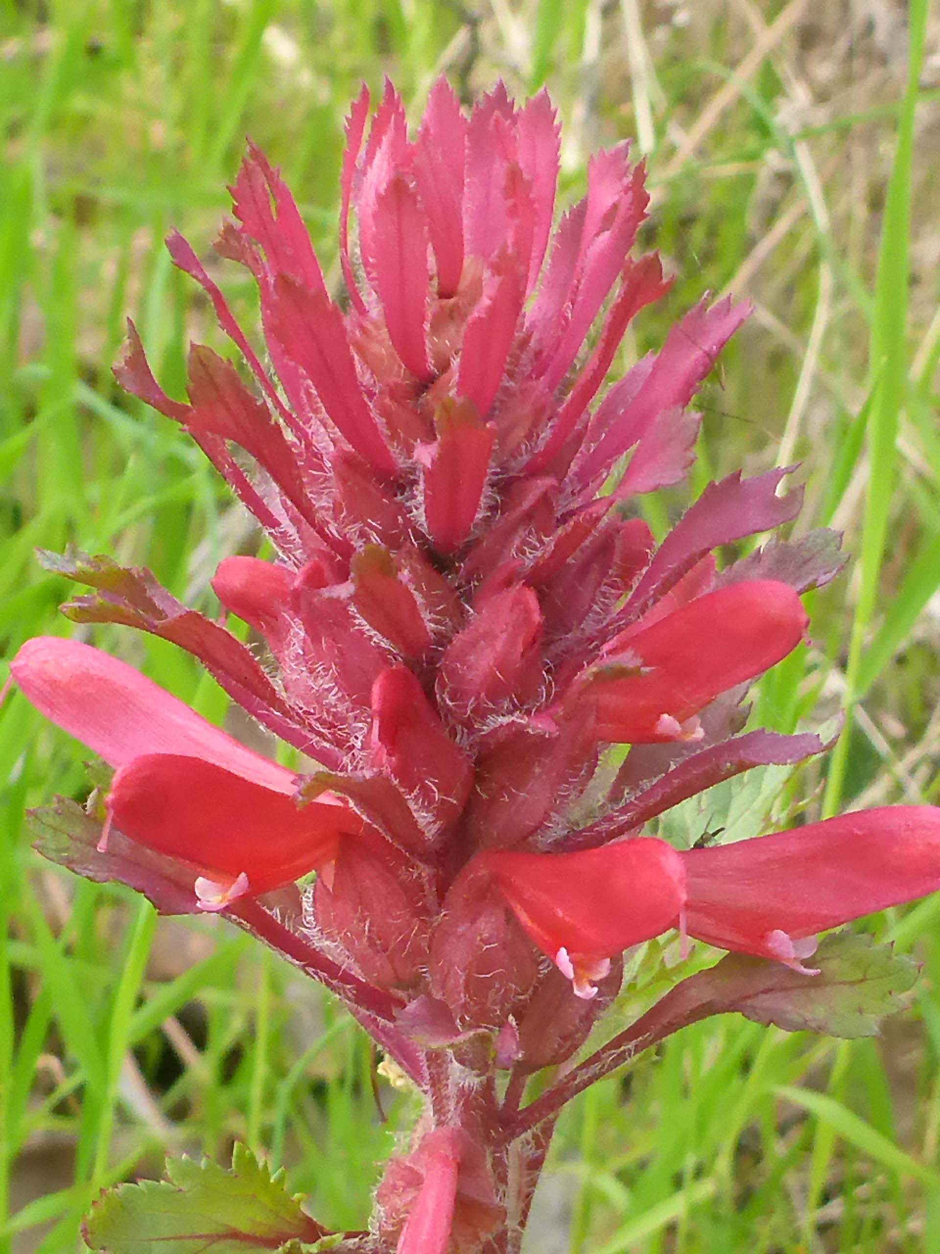
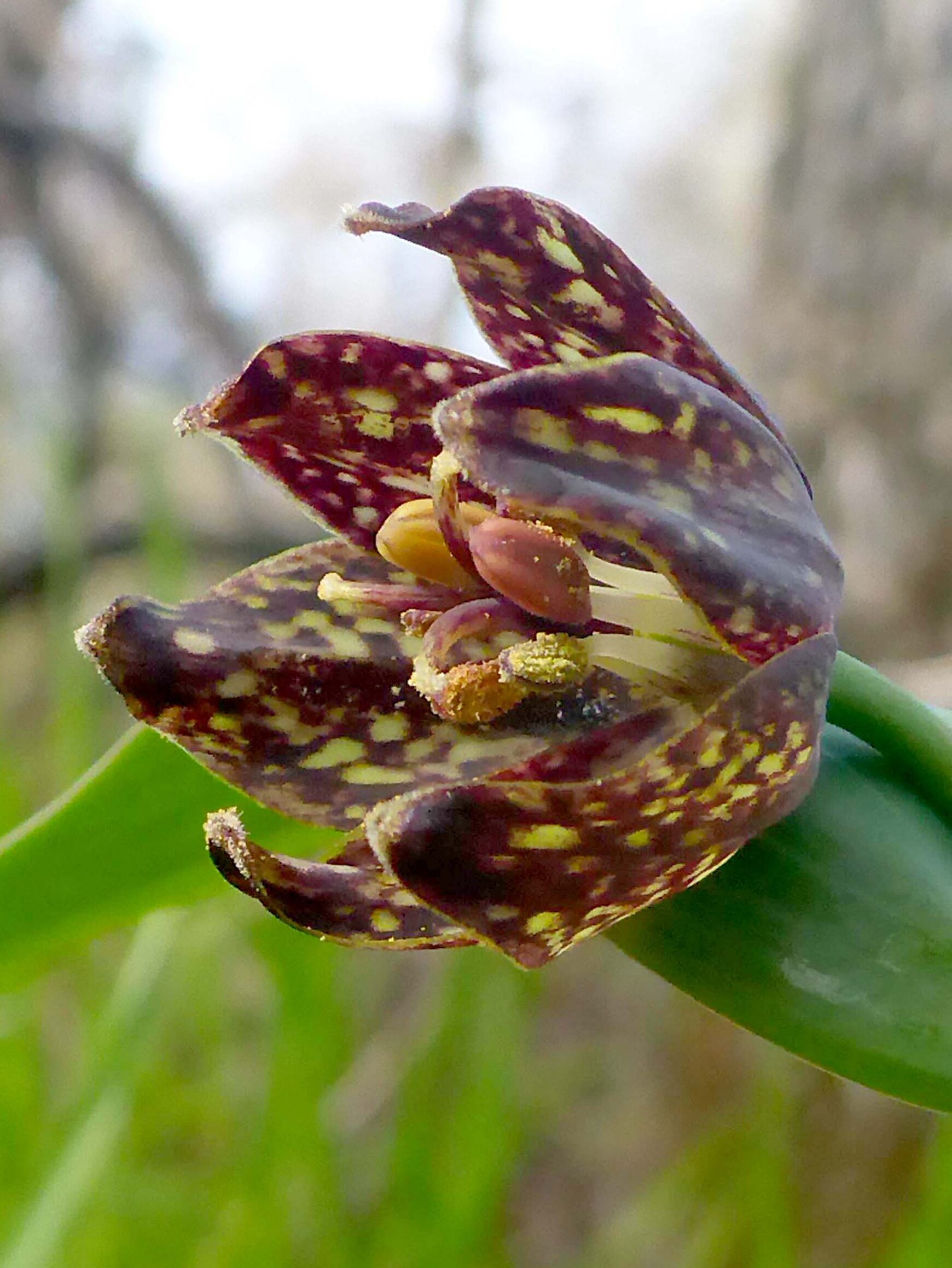
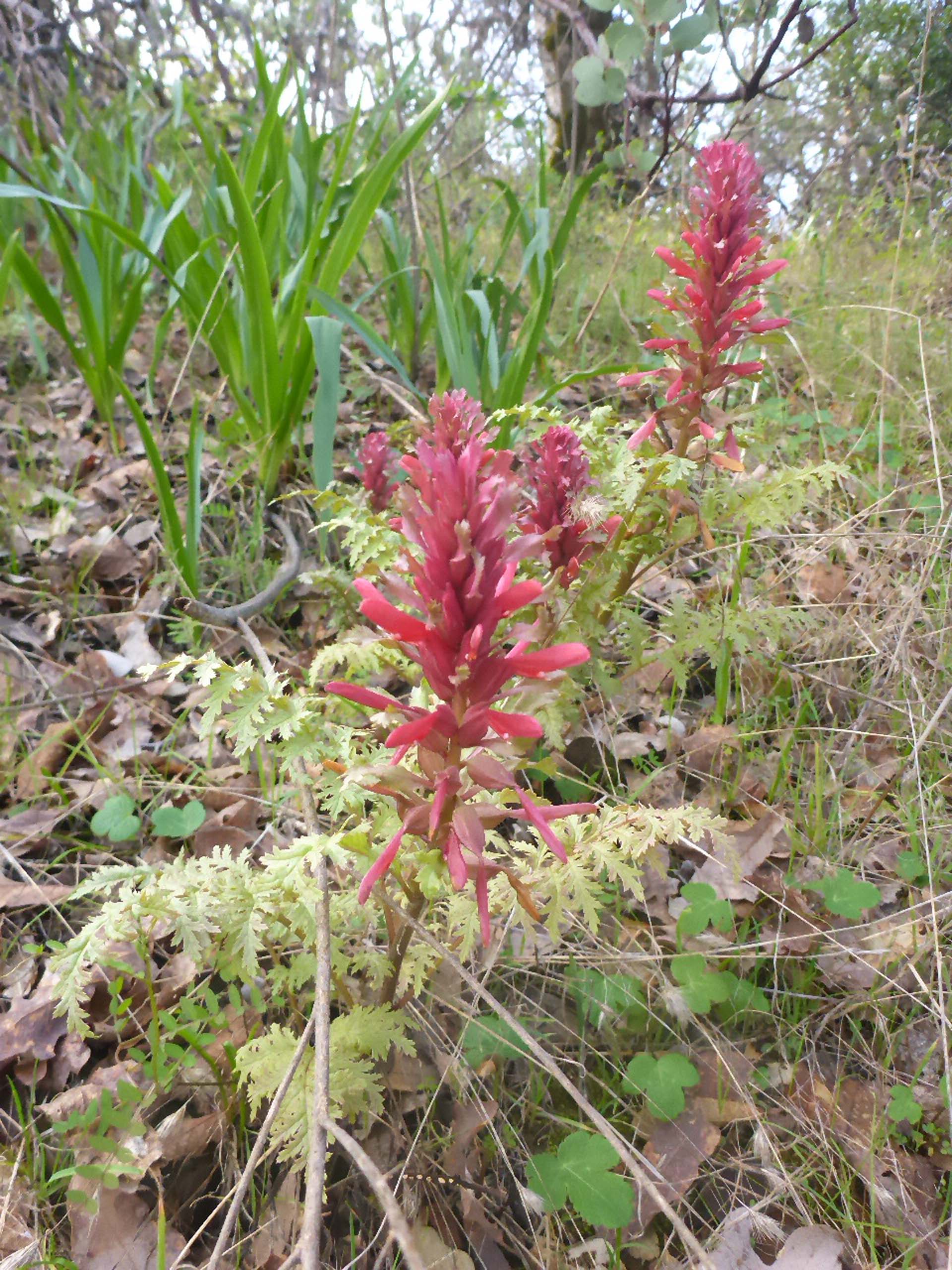
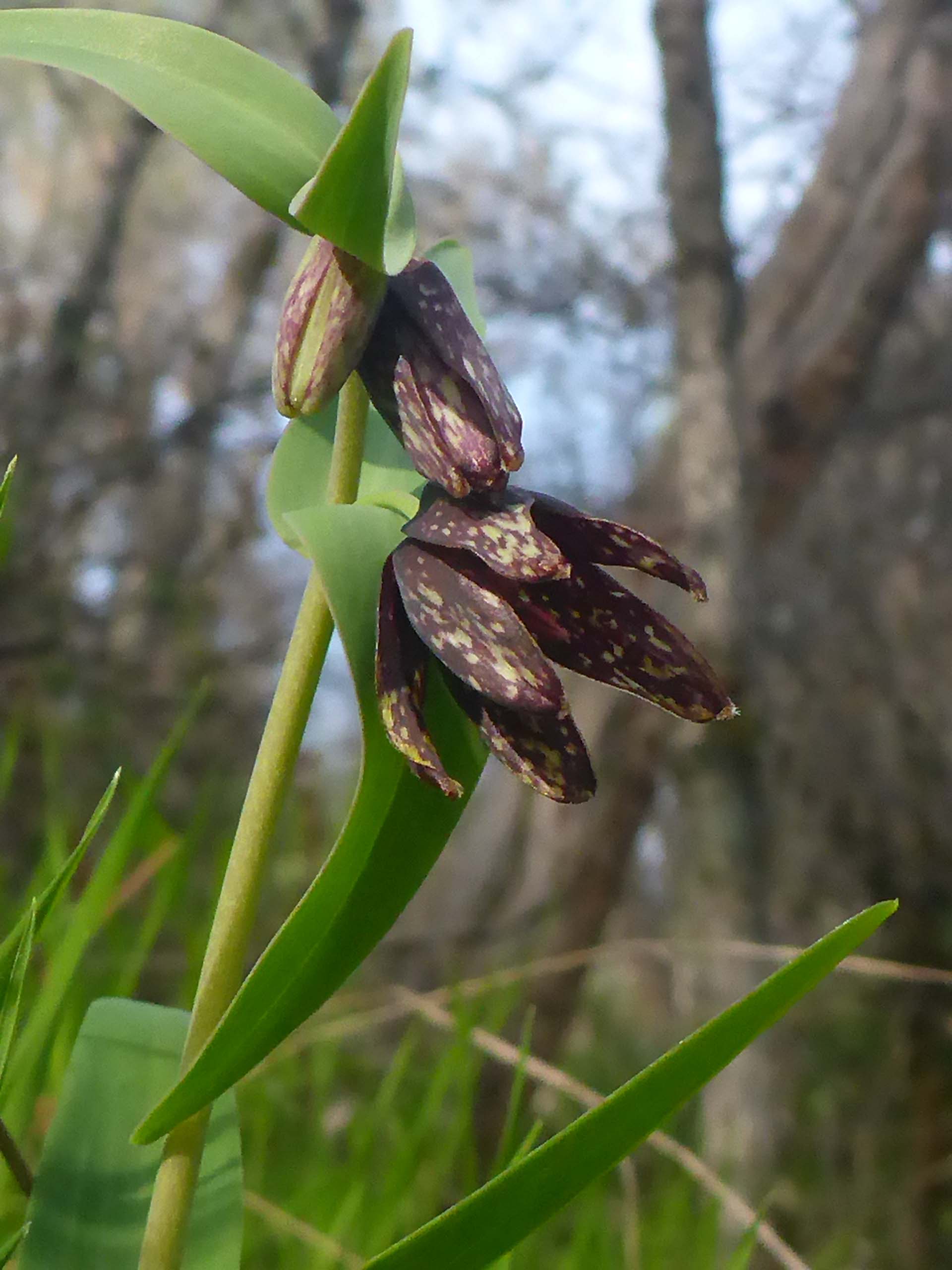
The connector trail from Spicewood Drive quickly dives down under the canopy of a beautiful blue oak woodland, replete with babbling brook, early-season grasses, and newly budding shrubs. On this warm, mellow day under bright blues skies, it very much felt like we were walking into a prelude to spring. In less than half a mile, we turned off of Sloppy Joe Trail onto “T” Party Trail, which generally wends northeast from there, and is a spectacular trail. It was along this trail that we found an abundance of Indian warriors (Pedicularis densiflora; AKA warrior’s-plume lousewort) in bloom—the first of the season for us. Always a happy sighting, there were dozens upon dozens of them—hundreds! Go now if you want to be wowed! But while you are there, keep your eyes peeled for checkered fritillary (Fritillaria affinis). We found a small population of these well camouflaged, gorgeous monocots near a bend where the trail passed over a drainage.
We also found wavy-leaved soap plant (Chlorogalum pomeridianum) leaves in the hundreds, if not thousands! If they all bloom, it will make for a stunning evening walk in a few months! Also in abundance were bumble bees. Many, many very large bumble bees bumbling about, doing who knows what. We wondered if these could be queens, looking for new nest sites.
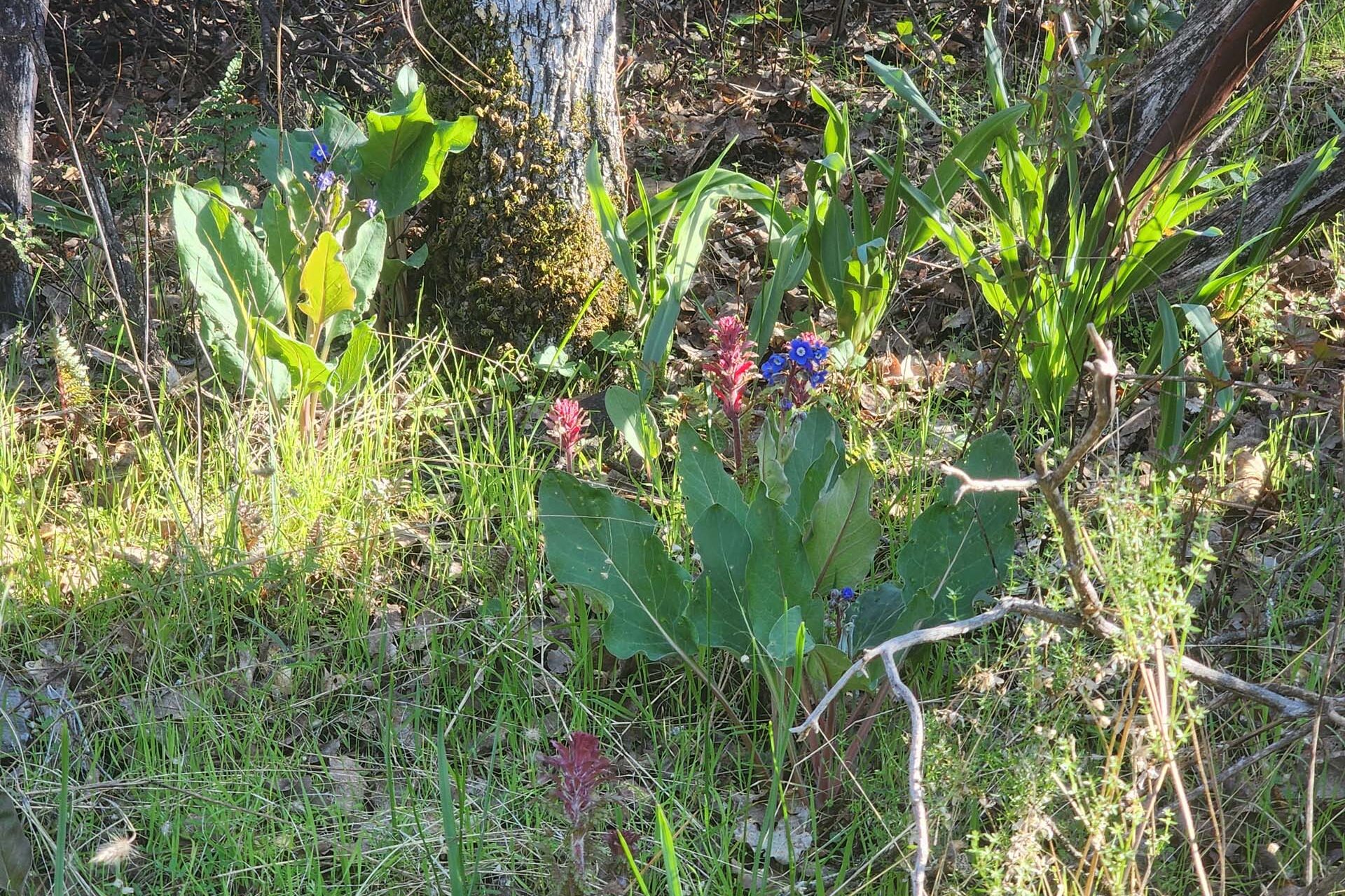
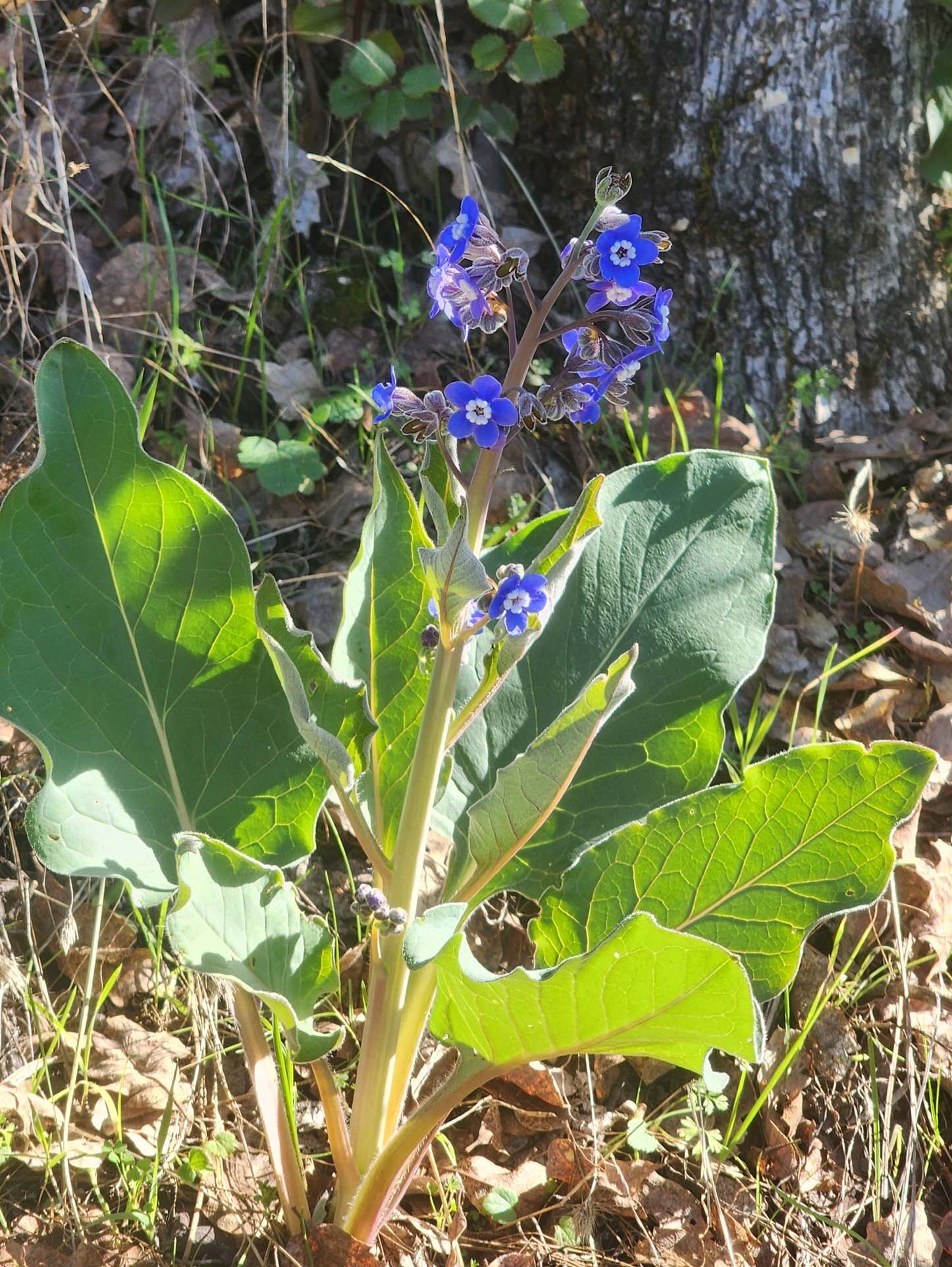
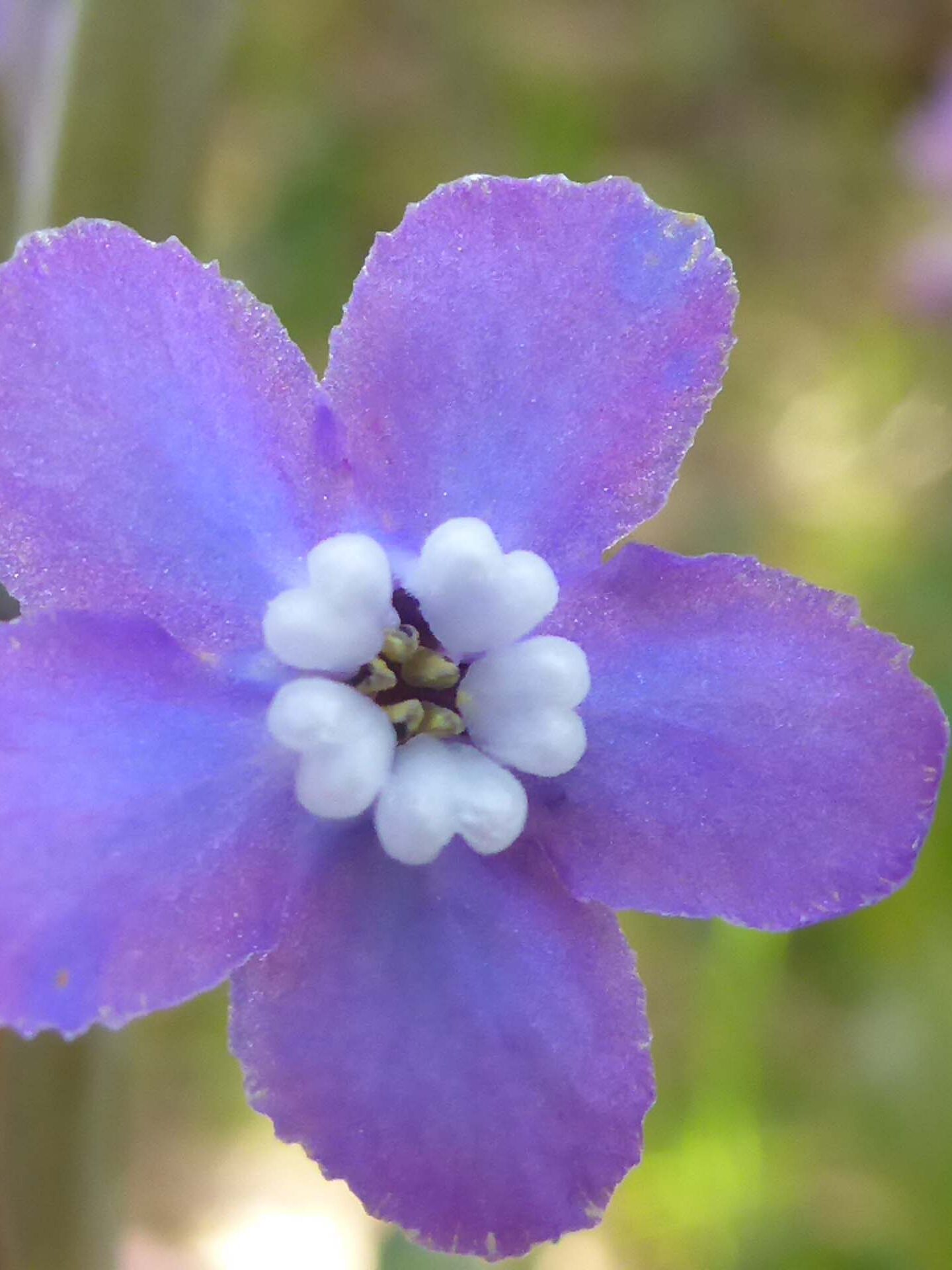
We hiked “T” Party for ~1.5 miles to where it reconnects with the northern section of the main Sloppy Joe Trail loop. On that side of the ridge, the aspect is noticeably different: blue oaks give way to interior live oaks and black oaks, and the understory becomes more dense. Here is where we found the most Pacific hound’s-tongue (Adelinia grandis) in bloom, and not just a few—yet another early-season delight.
Turning back onto Sloppy Joe Trail, this time heading east, we ended up back at its junction with the Spicewood Drive connector for a total hike of about 4.4 miles. We highly recommend this lovely neighborhood trail system—at least the Sloppy Joe-“T” Party loop that we did was spectacular. Do note that this trail system is open to mountain bikes, and we were indeed passed by a group of five bikers and a solo biker, but everyone was polite and courteous, and no one was careening around blind curves. Of course, it could have been a different story on some of the other steeper, more challenging trails, but the two trails we hiked seem very gently used by all. Just pick your trail and give it a try. And go check out those Indian warriors! ~Laurie & Don Burk