
Here’s an especially nice fall hike: Widow Lake from Butte Lake, Lassen Volcanic National Park. The starting point is at the northern-most entrance to the Park, 6 miles off of Highway 44 on a bumpy gravel road, at a huge parking lot and recreation area complete with toilets, picnic tables, ranger station, and campground. Despite the remoteness of this entrance to the Park, we are very often surprised at the number of cars we find parked there.
We were definitely shocked at the very full parking lot on this particular Sunday, but we had no reason to fear that it would be a freeway of hikers on our chosen trail—we didn’t see a single person all day long. We really should have not have been worried. At over 8 miles round trip, with over 1,300 feet of elevation gain, the hike to Widow Lake will not be on most day-trippers’ agendas. Another great reason to choose it!
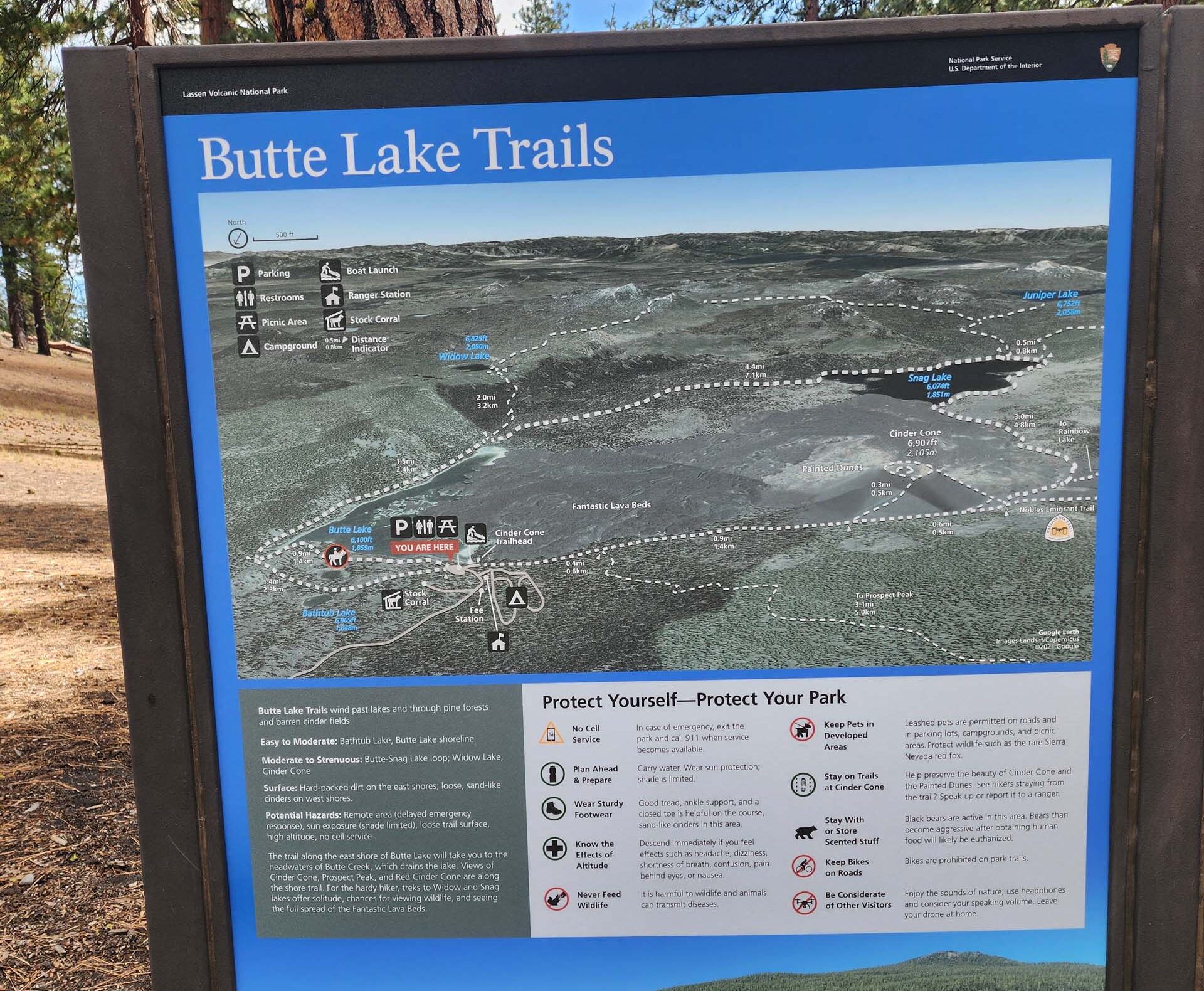
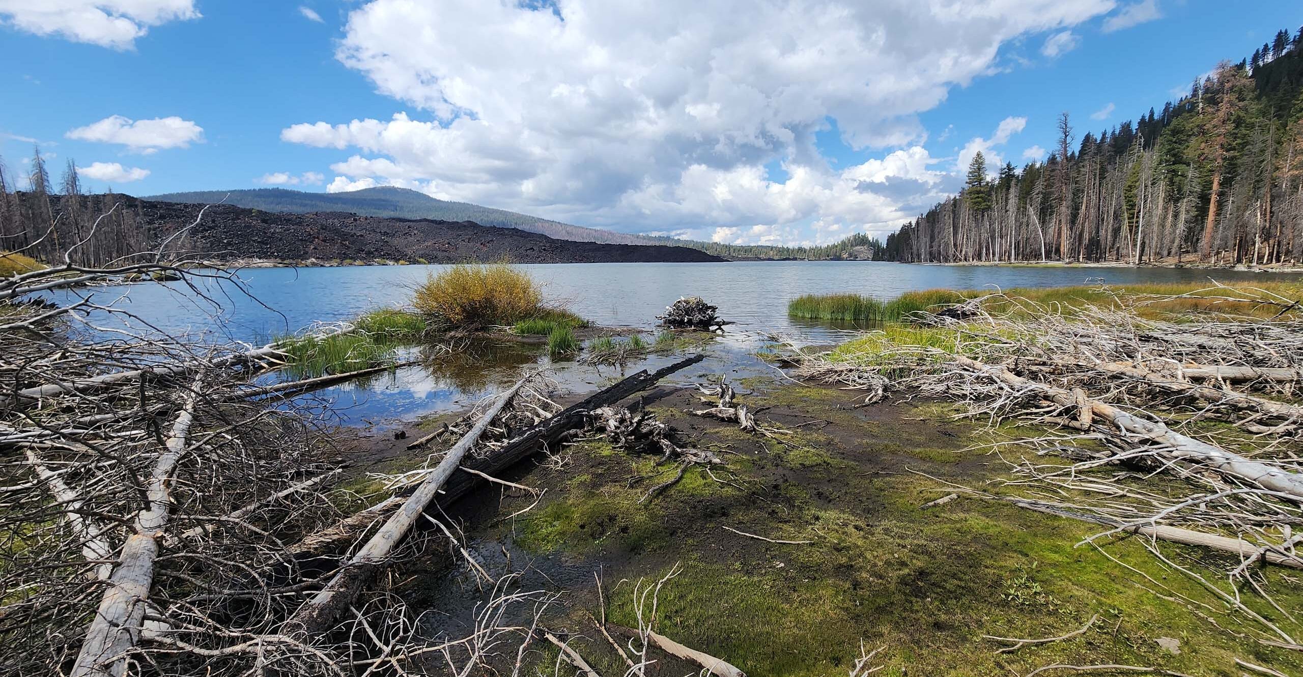
From the trailhead at the east end of the parking lot, the trail goes east, roughly following the northern shore of Butte Lake, climbing gently, then very steeply (but blissfully only for a very short distance!) to an impressive vista point of the lake at the top of a hill. If this is as far as you go on this trail, it will have been well worth the effort—it is a spectacular view. The trail then plummets sharply down to the outlet of Butte Lake, Butte Creek, which must be crossed however you can. Generally, there is a logjam that makes for a fairly easy crossing.
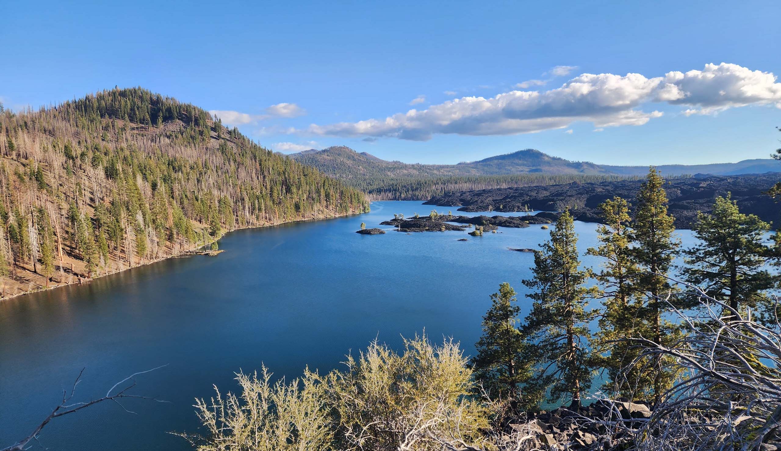
Once across the creek, you can choose to go north or south. The north trail makes a long loop back to the parking lot, past Bathtub Lake and another unnamed lake. The trail south follows the eastern shore of Butte Lake for about a mile, and is the route to Widow Lake. This section of trail is relatively flat or gently undulating, and hugs the shoreline for most of the way. At the southern end of Butte Lake, past a thicket of quaking aspen regrowth, the trail splits: left to Widow Lake, right to Snag Lake.
The sign at this junction says that it is another 1.4 miles to Widow Lake, and it could be, but the distances on the various signs do not add up. It’s definitely over a mile, and it is the most difficult stretch of trail. The first half or so of this leg is a nice trail, easily discerned, with a good footbed, that climbs gently southeast. Then comes the largest expanse of bracken we’ve ever seen!
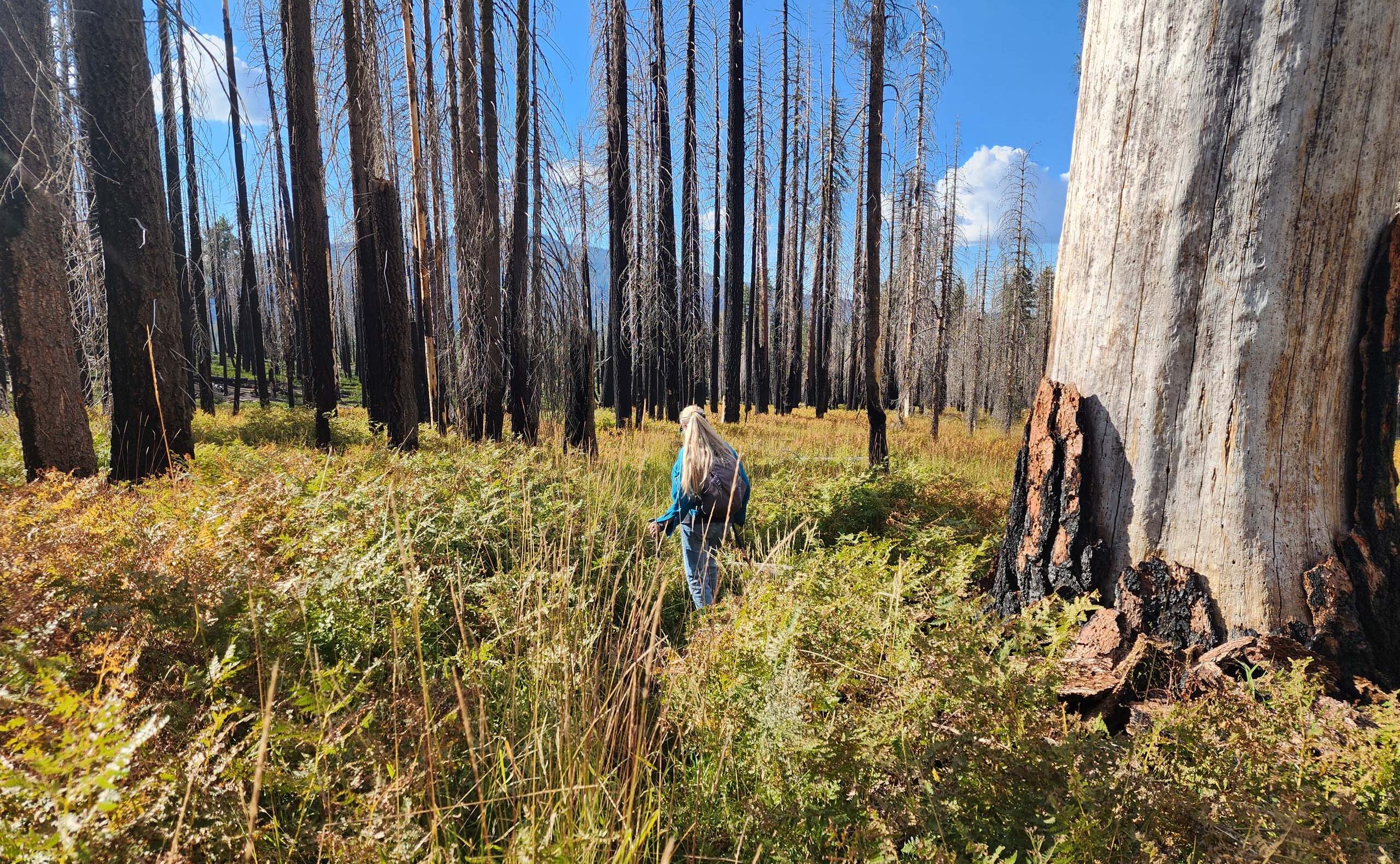
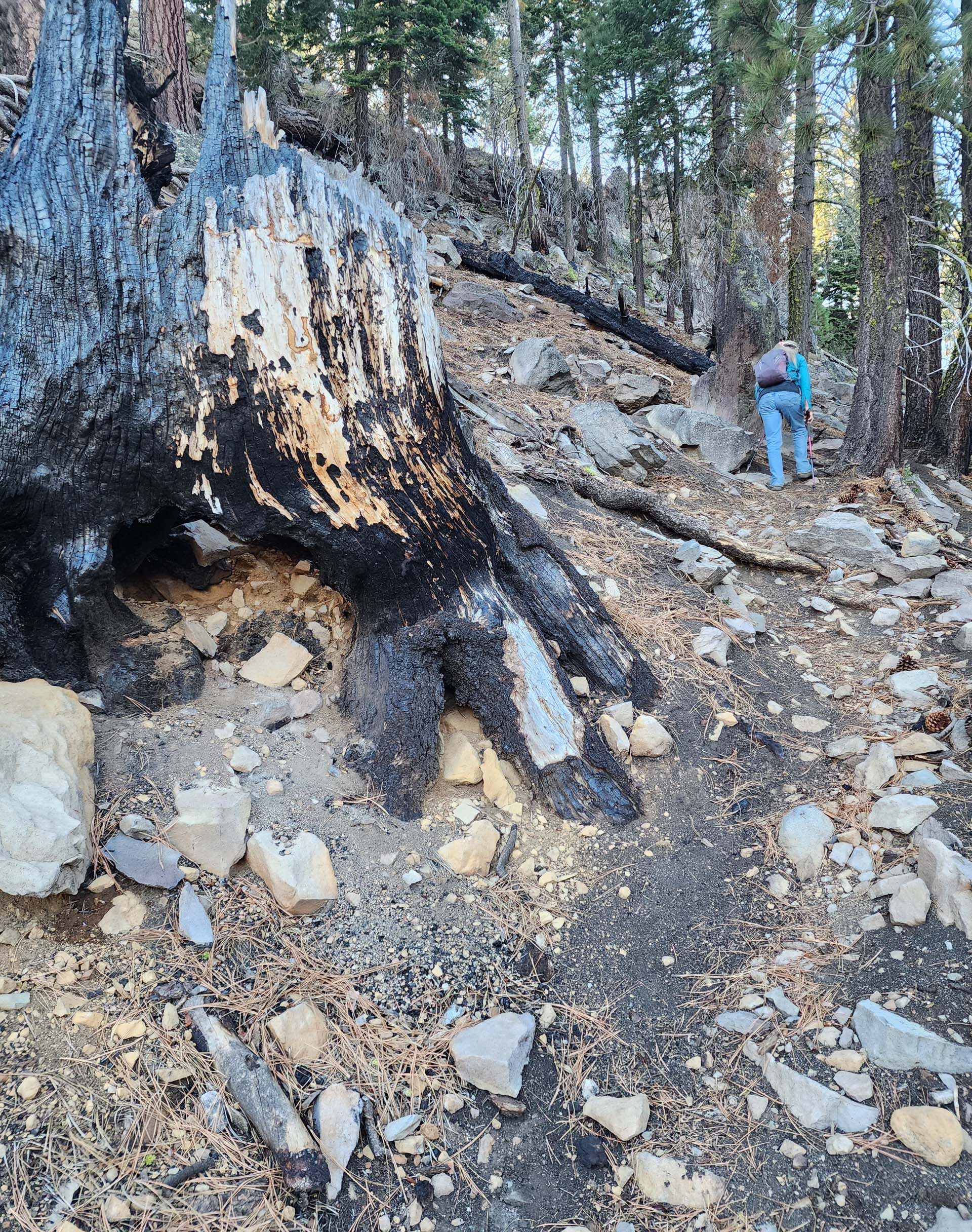
Once out the the bracken, the incline soon steepens to an insane pitch and the trail is easily lost in areas severely burned by the Dixie Fire of 2021. We consulted GPS and topo maps frequently in this section, and recommend that one does not try to find Widow Lake without these tools!
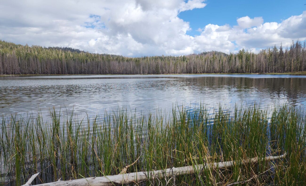
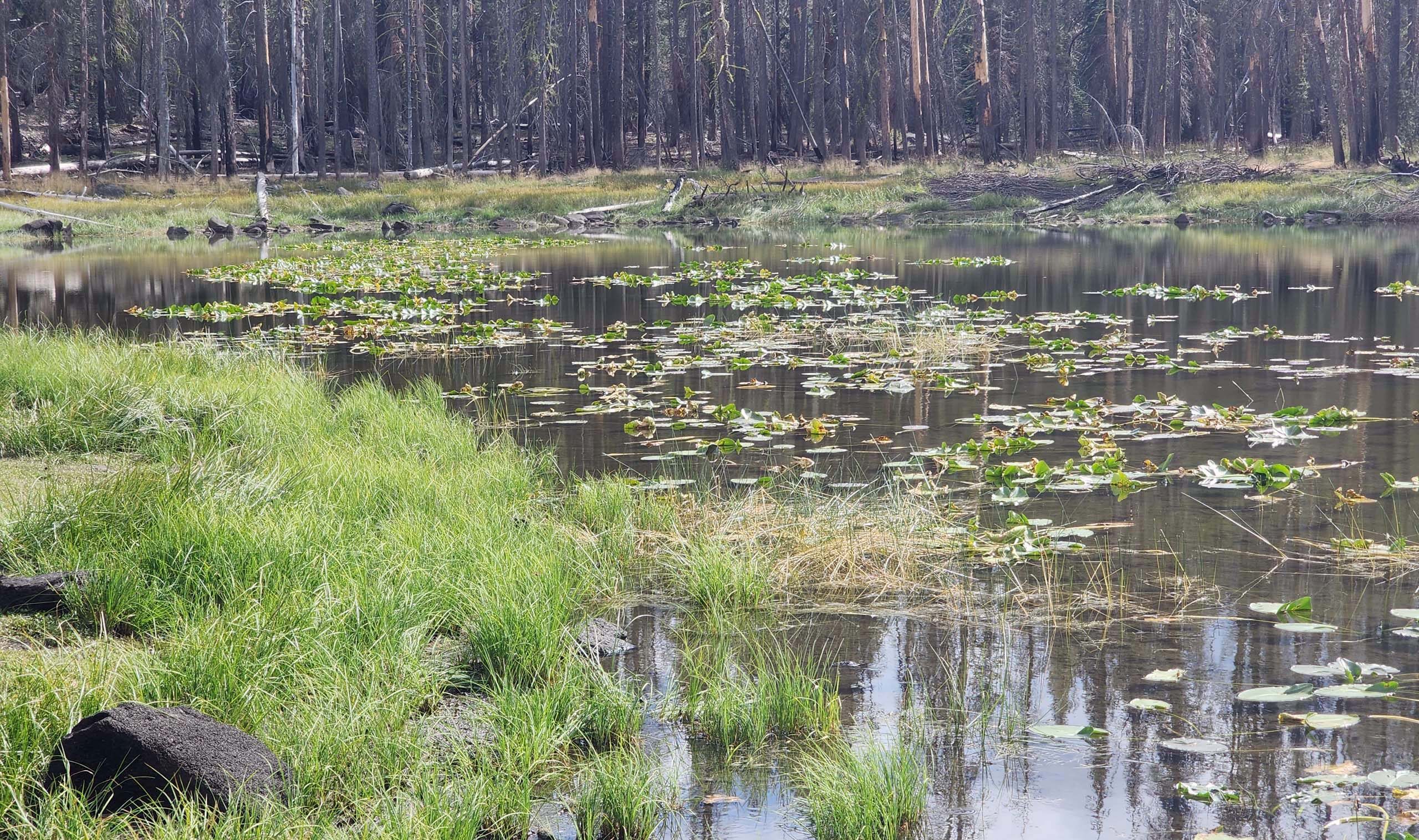
As soon as the trail crests the ridge, Widow Lake comes into view—a pretty little lake typical of LVNP. Our favorite part of this lake was the little overflow pond, separated from the larger lake this late in the season. There were yellow pond-lilies (Nuphar luteum) and Green-winged Teals floating about, and its meadowy wet edges were flushed purple with an amazing carpet of porterella (Porterella carnulosa).
This is a moderately strenuous hike of at least 8 mile (we logged 8.3), mostly through mixed conifer forest, almost all of which burned in the Dixie Fire, at various levels of severity. We had expected to see fall colors and very few bloomers. Instead, it was just the opposite: almost no fall colors were to be seen, but we tallied over four dozen species in bloom! Here are some of our favorite sights from this hike. All photos by Don Burk. Enjoy! ~Laurie & Don Burk
 Close-up of primrose monkeyflower, Erythranthe primuloides.


