
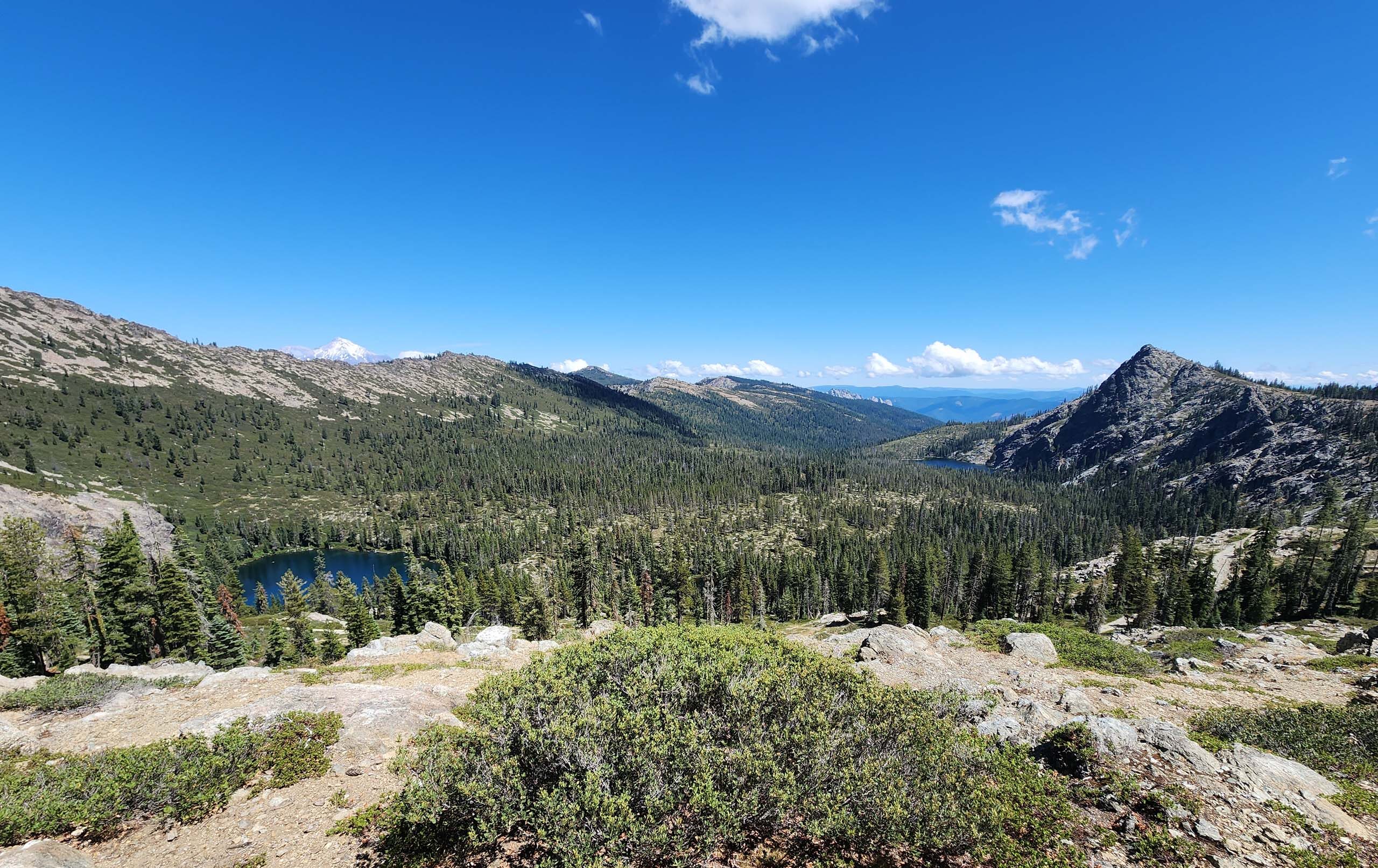
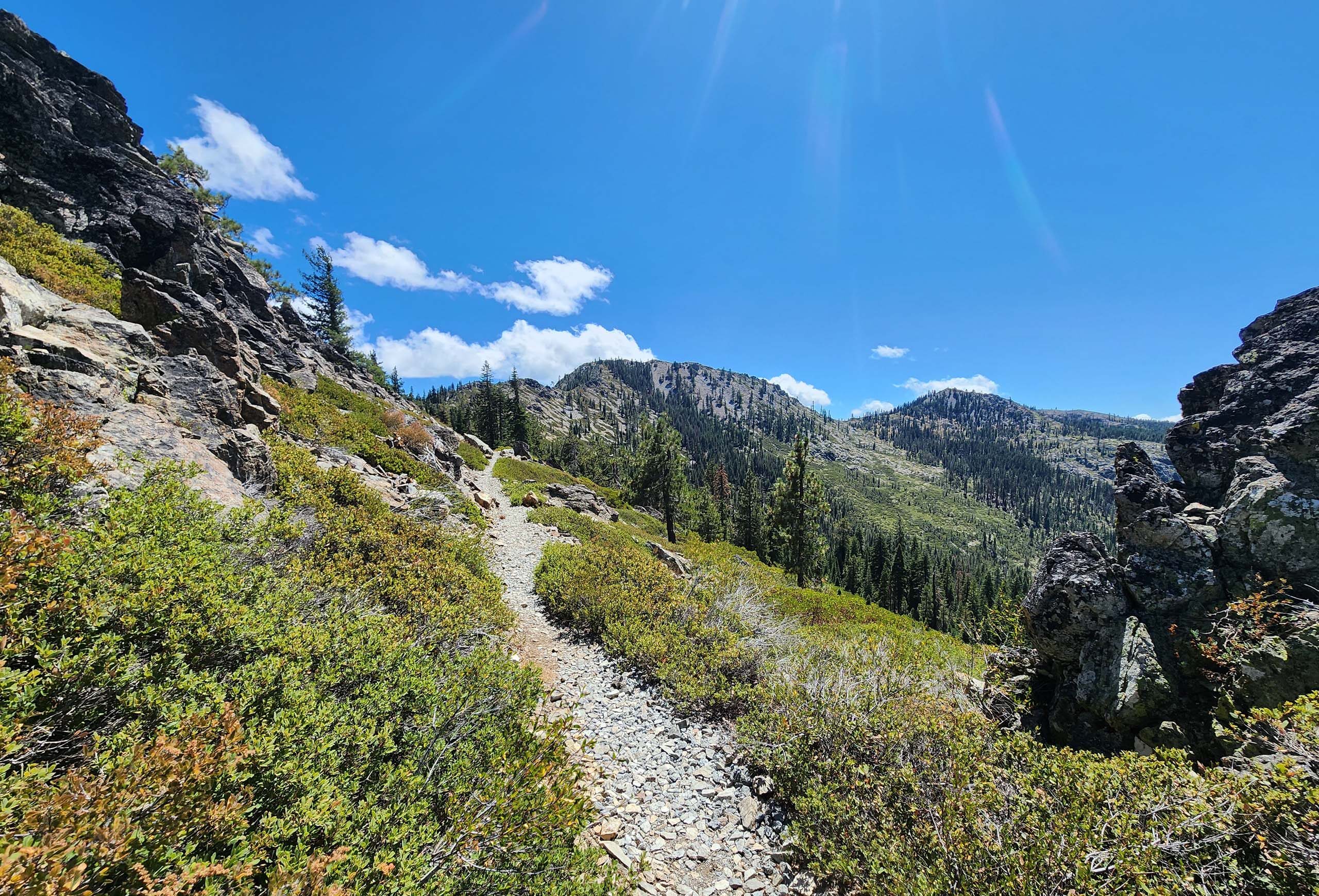
Here’s an absolute jewel of a hike that you won’t want to miss: Lake Helen via Gumboot Trailhead on the Pacific Crest Trail (PCT). It’s an easy to moderate 5.6-mile round-trip hike (only ~330 feet of elevation gain) along a section of the PCT that affords stunning views of Seven Lakes Basin and beyond to the east, and Mumbo Basin and beyond to the west.
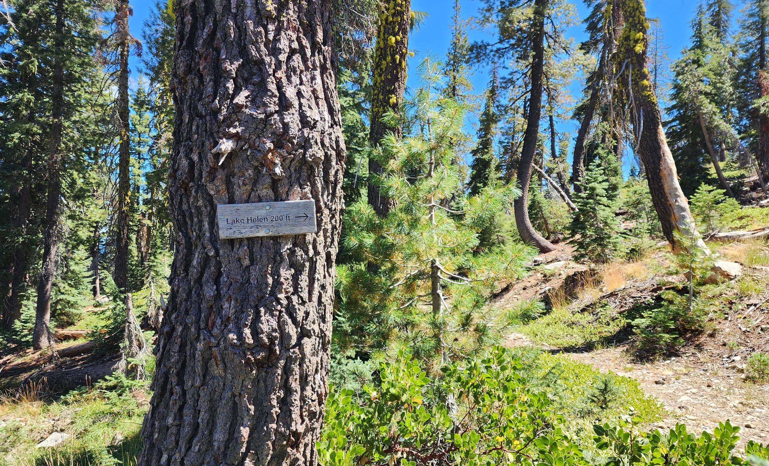
At about 2.25 miles south from Gumboot Trailhead, the PCT intersects with Seven Lakes Trail, which will take you to Lake Helen in another ~1 mile. A very short but steep path leads from the trail directly to very petty little Lake Helen.
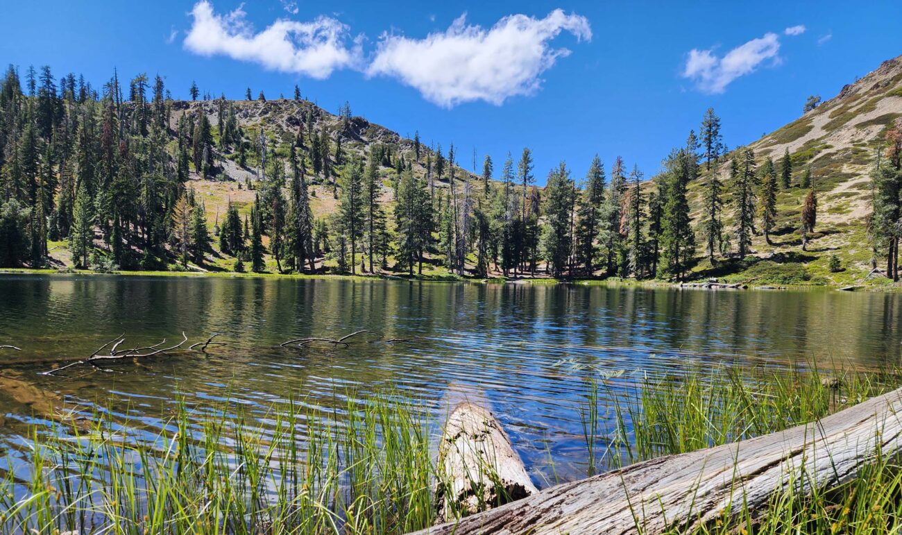
Supposedly Lake Helen is one of the most seldom visited lakes in the area; however, on the day we hiked there—on one of those unusually cool August days—we met at least two dozen hikers who were on their way out from Lake Helen. Granted, most were on an organized field trip. And in any case, by the time we got there, we had the lake all to ourselves.
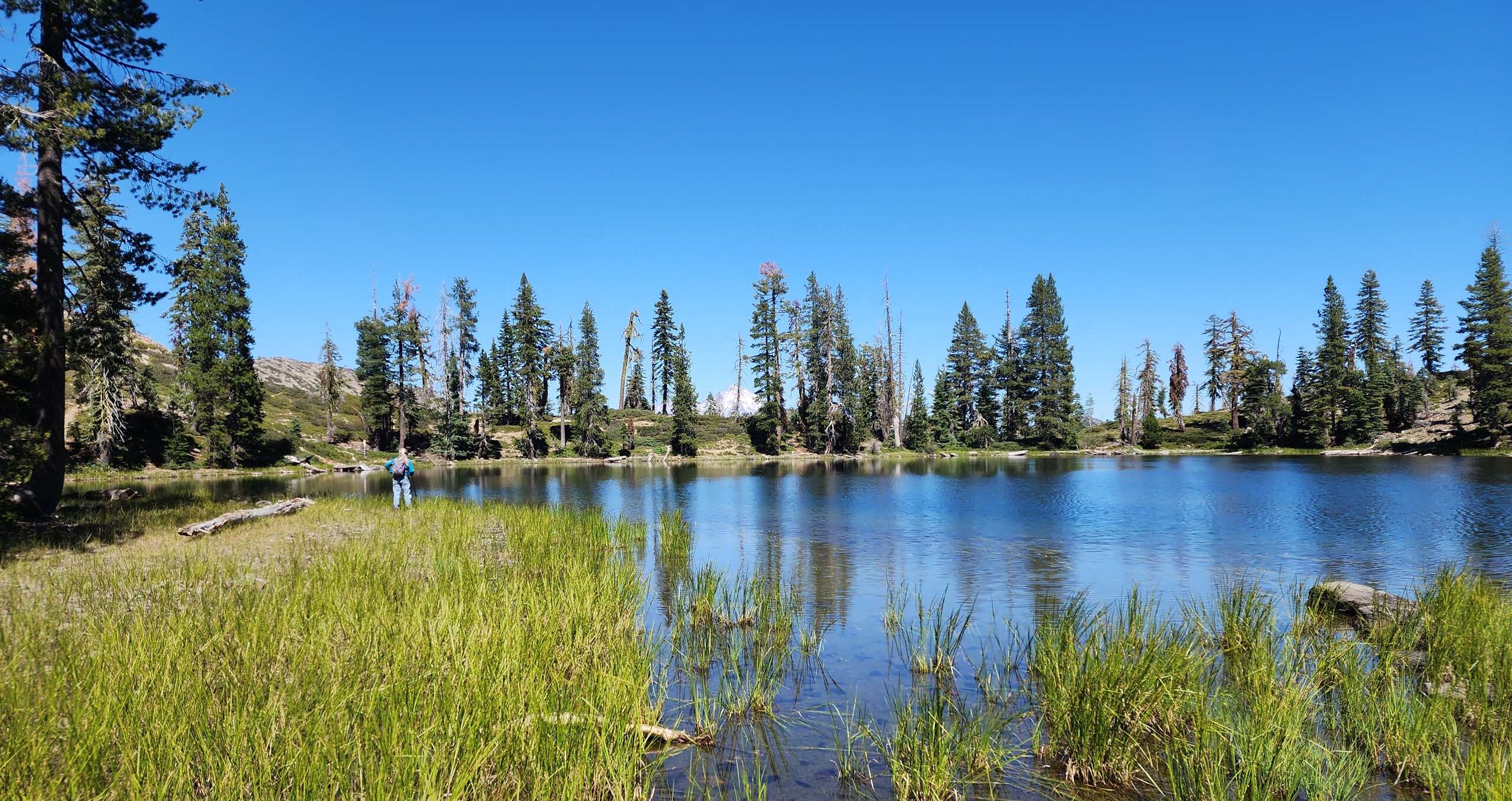
Photo taken August 18, 2024, by Don Burk.
While the lake was charmingly beautiful, the hike along the spine between basins was just as glorious—it is simply a wonderful hike all around. We highly recommend it.
To get there, from Box Canyon Dam on Lake Siskiyou, continue south on W.A. Barr Road, which converts to South Fork Road (Road 26). Make sure to stay on South Fork Road (Road 26) at road junctions, all the way to the top of Mumbo Summit where you’ll find Gumboot Trailhead. It’s about 15 miles from the dam; all roads are paved. From the trailhead, be sure to hike south on the PCT to its junction with Seven Lakes Trail and then on to Lake Helen.
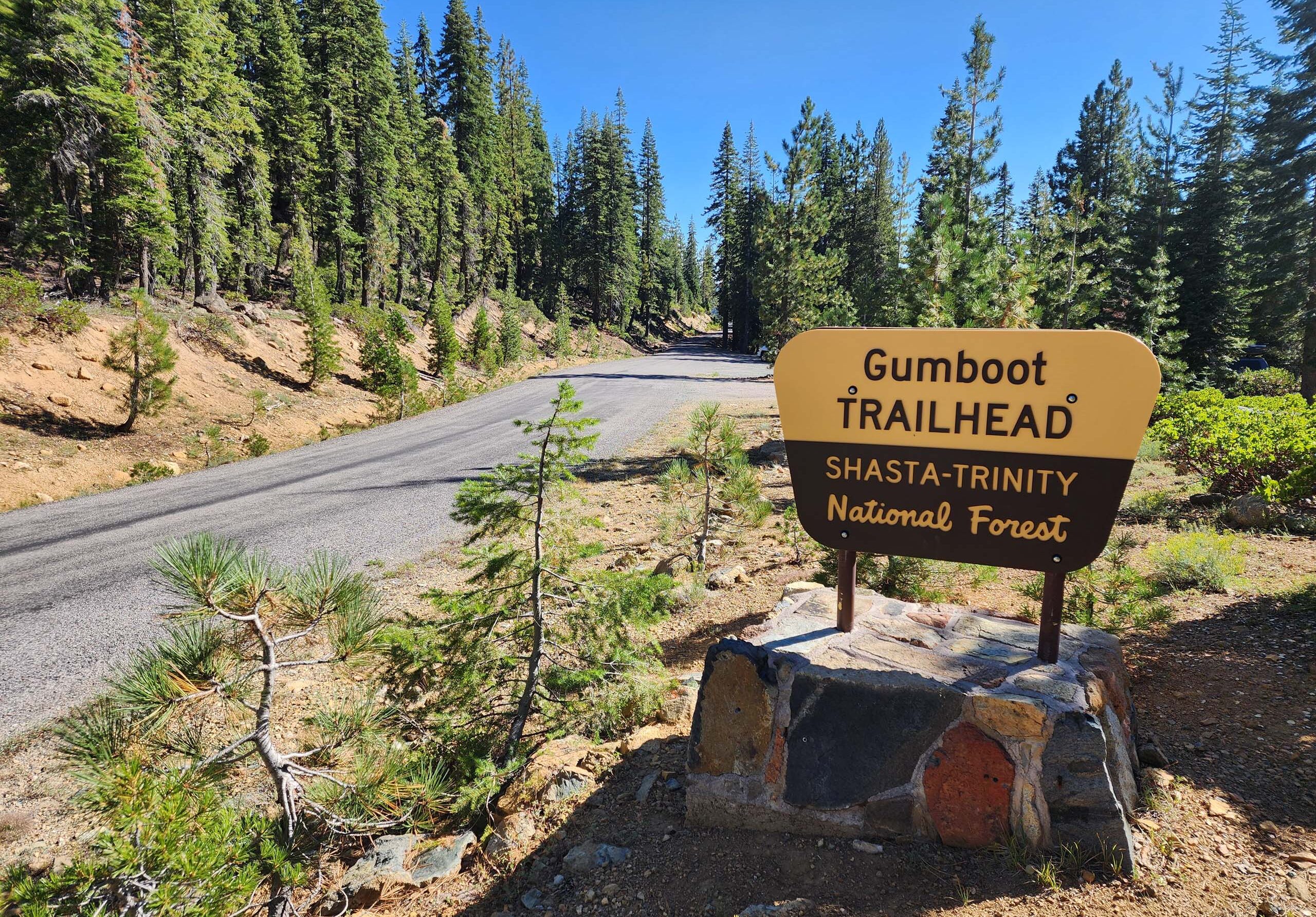
Photo taken August 18, 2024, by Don Burk.
And now for the botanical bit—not a lot was blooming! Which made every bloom that we did see all that more exciting. Here is a quick slideshow of some of the flora that caught our attention. All photos by Don Burk. Enjoy! ~Laurie & Don Burk


